3-day itinerary · Switzerland

3 Days in Interlaken

A realistic first-timer plan that starts gently on day one, with the funicular to Harder Kulm for the view of both lakes and the three peaks, a walk along the Höheweg, and an afternoon on the Lake Brienz boat to the Giessbach Falls and the village of Iseltwald; goes to the top of Europe on day two, the Jungfraujoch by the Eiger Express gondola and the cog railway, coming down by Kleine Scheidegg and Wengen to the Staubbach Falls at Lauterbrunnen; and spends day three in the Lauterbrunnen valley, inside the mountain at Trümmelbach Falls and up the world's steepest cable car to the Schilthorn and the car-free village of Mürren. Every stop comes with the fares, times and reservation rules that matter in 2026.

  • 3days
  • 12sights
  • 1.5 kmon foot between sights

Updated 12 September 2026 · 7 official sources checked · report an error

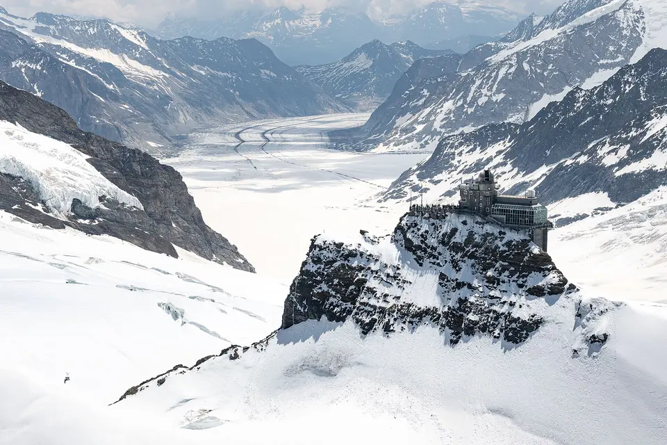
Jungfraujoch, Top of Europe
Photo: kuhnmi, CC BY 2.0

The lakes and the town, then the Jungfraujoch, then the Lauterbrunnen valley

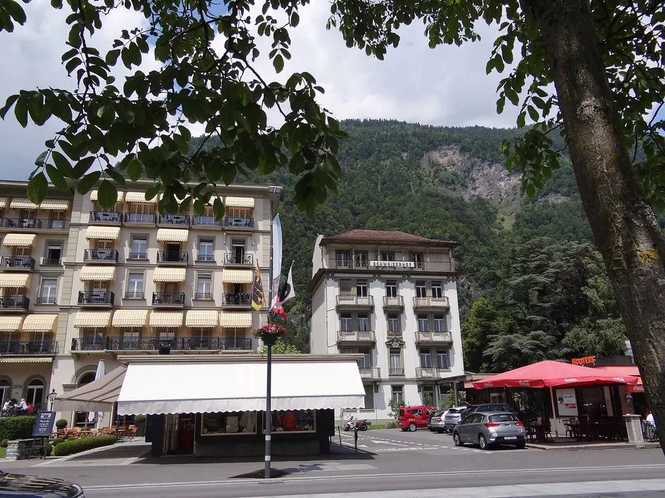
Interlaken works by rail and boat, and the plan is built on the timetable: the Harder Kulm funicular from 9:10, the Lake Brienz boats from Interlaken Ost, the first trains to the Jungfraujoch at 7:04 and 7:34, which are the ones to take, and the Stechelberg cable car for the Schilthorn. From May to October a seat reservation on the Jungfrau railway is compulsory and the mountain is cheapest on the Good Morning ticket; a Jungfrau Travel Pass covers almost everything except the Jungfraujoch itself, and a Swiss Travel Pass halves the mountain fares. Day one is walkable and low; days two and three are high, cold at the top even in August, and depend on the weather, so swap them around the forecast and the mountain webcams.

At a glance

Ways to use these days

For the view
Harder Kulm
Lightest day on foot
Day 2 — 9.4 km between stops
Most walking
Day 1 — 26.1 km

Day 1

Harder Kulm, the Höheweg and Lake Brienz

Ride the funicular up to Harder Kulm for the view over both lakes to the Eiger, Mönch and Jungfrau, walk the Höheweg and the Höhematte meadow where the paragliders land, take the boat from Interlaken Ost across Lake Brienz to the Giessbach Falls, and finish in the fishing village of Iseltwald.

  • 5 sights
  • 1.5 km on foot
  • Longest walk 1.5 km
123455 kmN
Stops in order, straight-line distancesDriving route in Google Maps ↗

Morning

Harder Kulm
Photo: Dietrich Michael Weidmann, CC BY-SA 3.0
1Viewpoint

Harder Kulm

Interlaken's own mountain, 1,322 metres, is ten minutes up from the town by the 1908 funicular, and the Two Lakes Bridge platform cantilevered off the summit looks down on Lake Thun to the west, Lake Brienz to the east, the town between them and, across the valley, the Eiger, Mönch and Jungfrau in a row; the restaurant terrace below it does the same view with a coffee. Go first thing, before the haze and the crowds, or come back for the sunset on a summer evening.
  • Plan about 1 h 30 min
  • Funicular April 3–November 29, 2026, from 9:10 about every 30 minutes; tickets from CHF 22 return, half price with the Swiss Travel Pass or Half Fare Card, free with the Jungfrau Travel Pass
1.5 km · about 24 min on foot
The Höheweg and the Höhematte
Photo: Foto Fitti, CC BY-SA 3.0
2Promenade and meadow

The Höheweg and the Höhematte

The town's main street runs between its two stations past the grand hotels of the 1870s, the Victoria-Jungfrau above all, the casino gardens and the Höhematte, the 14-hectare meadow the townspeople bought in 1864 to keep the view of the Jungfrau open forever; the paragliders who launch from Beatenberg all land on it, one after another, all day. Walk it, watch them, and cross the Aare into Unterseen, the old town with the 13th-century church square that Interlaken forgot to build itself.

  • Plan about 1 h

Midday

LunchLunch on the boat, which serves a full menu on most sailings, or before boarding in Interlaken: rösti and Älplermagronen at a Höheweg brasserie, or the market and bakeries of Unterseen's old square across the river.

Afternoon

The Harder funicular's valley station is 5 minutes from Interlaken Ost, where the boats leave from the quay behind the station
Lake Brienz by boat
Photo: GabrielleMerk, CC BY-SA 4.0
3Boat trip

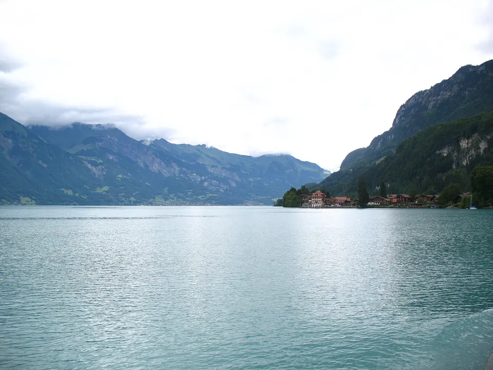
Lake Brienz by boat

The narrow lake east of the town is the colour of a glacier, an opaque turquoise from the rock flour the Aare and the Lütschine carry into it, and the BLS boats that leave from the quay behind Interlaken Ost station sail its length to Brienz in 75 minutes, calling at Iseltwald, Giessbach and the villages of the north shore under cliffs and waterfalls. The 1914 paddle steamer Lötschberg does the run in summer. Sit on the open deck at the back; the Swiss Travel Pass covers the fare.

  • Plan about 1 h
  • Boats from early April to early December; full trip Interlaken Ost–Brienz 75 minutes; covered by the Swiss Travel Pass and the Jungfrau Travel Pass
Boat from Interlaken Ost, about 55 minutes; the Giessbach funicular, the oldest in Europe, climbs from the landing stage to the hotel and the falls
Giessbach Falls
Photo: Andrew Bossi, CC BY-SA 2.5
4Waterfall

Giessbach Falls

On the south shore, the Giessbach stream comes down 400 metres in fourteen steps through the forest straight into the lake, and the Grandhotel Giessbach of 1874, saved from demolition in the 1980s by a public subscription, stands halfway up it with a terrace looking over the water; from the boat landing, Europe's oldest funicular of 1879 climbs to the hotel in four minutes, and a path goes on up behind the falls, where you can walk under the middle cascade. Have a drink on the terrace and take the boat on.

  • Plan about 1 h 15 min

Evening

Boat back from Giessbach towards Interlaken, 20 minutes; return to Interlaken Ost by boat or bus 103, about 25 minutes
Iseltwald
Photo: Sidharthmittal13, CC BY-SA 4.0
5Lakeside village

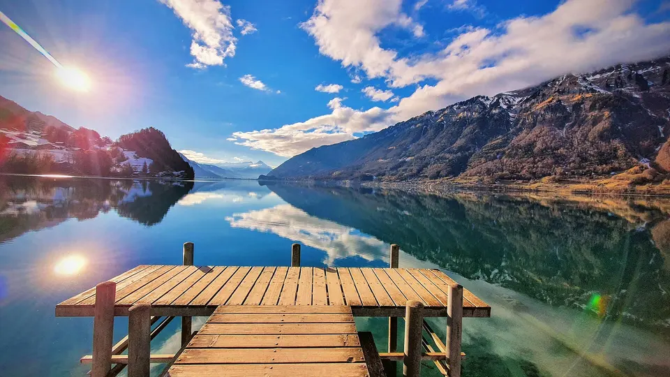
Iseltwald

A fishing village on a small peninsula on the south shore, with a castle from 1900 on the point, boathouses, a shingle beach and the wooden pier where a scene of the Korean drama Crash Landing on You was filmed, which now has a turnstile and a small fee for the photograph; the lake trout and whitefish are served in the village restaurants. It is the quietest stop on the lake and the right place to end the afternoon before the boat or the bus back to Interlaken.

  • Plan about 1 h

Day 2

The Jungfraujoch, Kleine Scheidegg, Wengen and Lauterbrunnen

Take one of the first two trains from Interlaken Ost to Grindelwald Terminal and the Eiger Express gondola up the north face to the Eiger Glacier, then the cog railway through the mountain to the Jungfraujoch at 3,454 metres for the Sphinx terrace, the Aletsch Glacier and the Ice Palace; come down the other way by Kleine Scheidegg under the Eiger, the balcony village of Wengen and the Staubbach Falls at Lauterbrunnen.

  • 4 sights
  • Transport between sights
12342 kmN
Stops in order, straight-line distancesDriving route in Google Maps ↗

Morning

Jungfraujoch, Top of Europe
Photo: kuhnmi, CC BY 2.0
1Mountain station

Jungfraujoch, Top of Europe

The saddle between the Mönch and the Jungfrau at 3,454 metres has had a railway station since 1912, when the Jungfrau railway finished its tunnel through the Eiger and the Mönch after sixteen years of drilling, and it is the highest in Europe: the Sphinx observatory terrace at 3,571 metres looks down the 23-kilometre Aletsch Glacier, the largest in the Alps, the Ice Palace is a tunnel of ice sculptures cut into the glacier, and the Plateau outside is snow in August. Since 2020 the Eiger Express gondola from Grindelwald Terminal cuts the journey from Interlaken to 90 minutes. Take the first train: the weather is clearest and the crowds thinnest before 11:00, and the Good Morning ticket is cheaper for it.

  • Plan about 3 h
  • First trains from Interlaken Ost 7:04 and 7:34; seat reservation compulsory May 1–October 31, CHF 10; Good Morning ticket from CHF 190.40, descent by 13:17; full return from Interlaken Ost over CHF 200 in high season

Midday

LunchThe Jungfraujoch has a self-service restaurant, the Crystal restaurant and a Lindt shop, all expensive and busy by noon; the better lunch is lower down, on the terrace at Kleine Scheidegg with the Eiger's north face filling the window, or a picnic bought in Interlaken.

Afternoon

Jungfrau railway down from the Jungfraujoch, 35 minutes
Kleine Scheidegg
Photo: Fischer.H, CC BY-SA 4.0
2Mountain pass

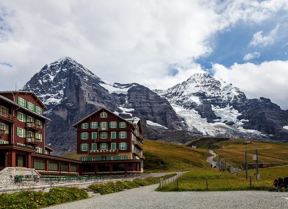
Kleine Scheidegg

The pass at 2,061 metres where the Wengernalp railway from both valleys meets the Jungfrau railway is the spot the north face of the Eiger was watched from through the tragedies of the 1930s, with telescopes on the hotel terrace: the wall rises 1,800 metres straight out of the meadow behind the station. Get off on the way down, eat on the terrace, and walk the 30-minute panorama trail towards Wengernalp before the next train.

  • Plan about 1 h
Wengernalp railway from Kleine Scheidegg, 25 minutes
Wengen
Photo: chensiyuan, CC BY-SA 4.0
3Mountain village

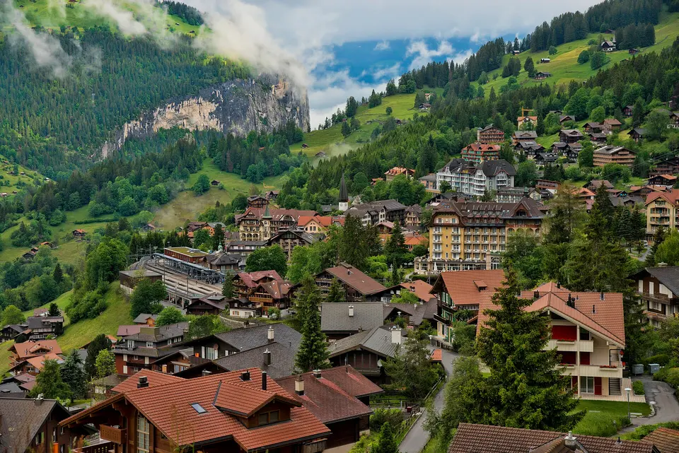
Wengen

The car-free village on the terrace 400 metres above the Lauterbrunnen valley, reached only by the cog railway, has been a British resort since the 1890s and is the finish of the Lauberhorn, the longest downhill in the ski World Cup; in summer it is chalets, a promenade with the Jungfrau in the window, and the Männlichen cable car for the walk back to Kleine Scheidegg. Stop for an hour on the way down, or stay for the sunset from the Wengen balcony and take a later train.

  • Plan about 1 h
Wengernalp railway from Wengen down to Lauterbrunnen, 15 minutes; then trains to Interlaken Ost every half hour, 20 minutes
Lauterbrunnen and the Staubbach Falls
Photo: Adrian Michael, CC BY-SA 3.0
4Village and waterfall

Lauterbrunnen and the Staubbach Falls

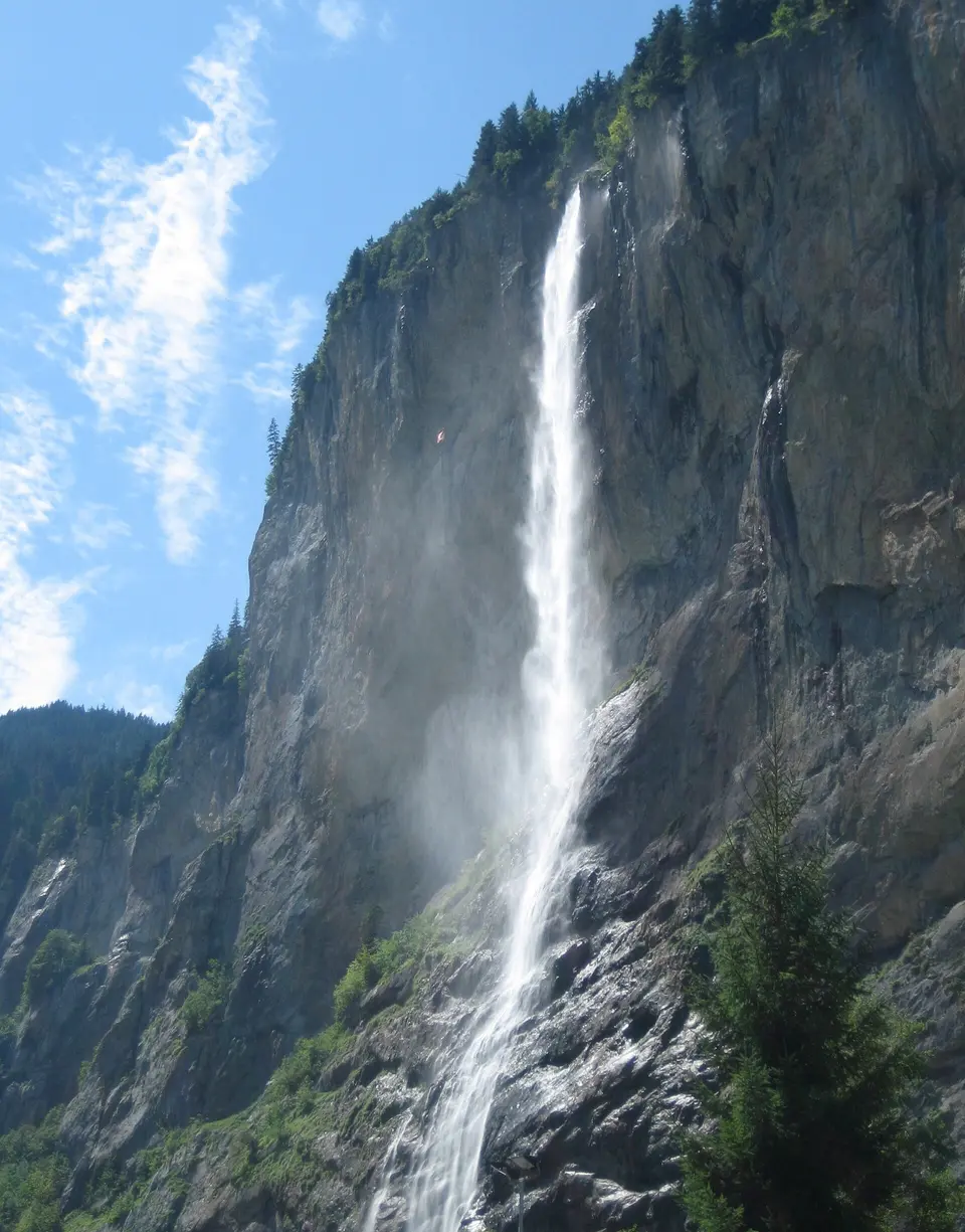
The valley Tolkien is said to have drawn Rivendell from is a glacial trough with sheer walls and 72 waterfalls, and the Staubbach, which falls 297 metres in a single free drop beside the village and turns to spray, the dust of its name, before it lands, is the one Goethe wrote a poem about; a path from the village climbs to a ledge behind the water in ten minutes. The village itself is a main street of chalets and the station, the base for Wengen, Mürren and the Jungfraujoch; walk to the falls at the end of the day, when the sun is on them.

  • Plan about 1 h
  • Free; the path behind the Staubbach Falls is open in summer, a 10-minute walk from the station

Evening

DinnerDinner in Lauterbrunnen with the Staubbach Falls lit above the village, or back in Interlaken, where the Höheweg hotels do fondue and the old town of Unterseen has the quieter restaurants.

Day 3

Trümmelbach Falls, the Schilthorn and Mürren

Go inside the mountain at Trümmelbach, where the meltwater of the Jungfrau glaciers thunders through ten falls in a gorge, then take the world's steepest cable car from Stechelberg to Mürren and on to the Schilthorn and the revolving Piz Gloria restaurant of the Bond film, and walk the car-free village of Mürren before the ride down.

  • 3 sights
  • Transport between sights
1231 kmN
Stops in order, straight-line distancesDriving route in Google Maps ↗

Morning

Trümmelbach Falls
Photo: Simisa, CC BY-SA 3.0
1Waterfall

Trümmelbach Falls

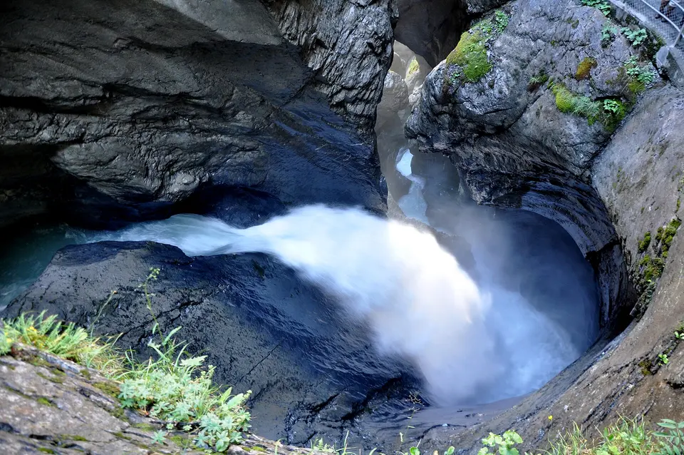
The meltwater of the Eiger, Mönch and Jungfrau glaciers, 20,000 litres a second in summer, drains through a single gorge inside the mountain at the head of the Lauterbrunnen valley, and Trümmelbach is the only glacier waterfall in Europe you can walk into: a tunnel lift and stairs lead to ten falls in a spiralling chute of polished rock, lit and thundering, spray in your face. Rain gear is useful; children under four are not admitted for safety.

  • Plan about 1 h 15 min
  • Early April to early November, 9:00–17:00, July–August 8:30–18:00; about CHF 18 adults, CHF 8 children 6–15; no children under 4
Bus 141 on to Stechelberg, 5 minutes; cable car Stechelberg–Mürren (4 minutes on the new line), then Mürren–Birg–Schilthorn, about 20 minutes
Schilthorn and Piz Gloria
Photo: Ank kumar, CC BY-SA 4.0
2Mountain summit

Schilthorn and Piz Gloria

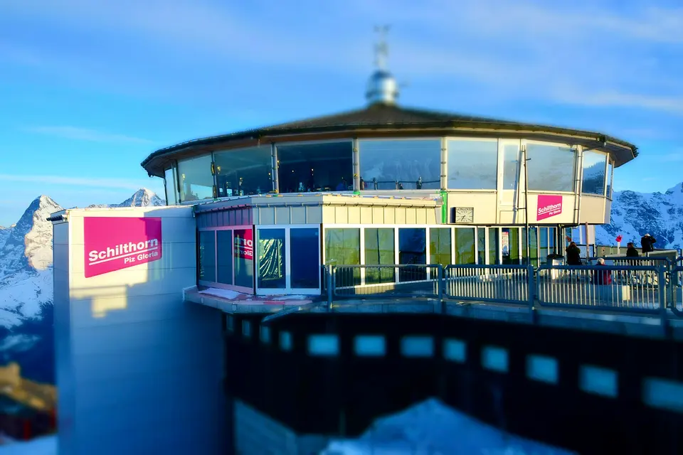
The 2,970-metre summit across the valley from the Jungfrau has the wider view, 200 peaks from the Eiger to Mont Blanc, and the revolving restaurant Piz Gloria on top, built in 1967 and finished with the money of the Bond film On Her Majesty's Secret Service, which was shot here in 1969 and is celebrated in the Bond World exhibition and the 007 walk of fame; at the Birg middle station, the Thrill Walk is a glass-floored catwalk bolted to the cliff. Since December 2024 the new Stechelberg–Mürren cableway, the steepest in the world at 159 per cent, does the first leg in four minutes.

  • Plan about 2 h 30 min
  • Stechelberg–Schilthorn return CHF 115, CHF 57.50 with the Half Fare Card, CHF 45.70 with the Swiss Travel Pass; from Mürren CHF 91.40; maintenance closure October 19–30, 2026

Midday

LunchPiz Gloria, the revolving restaurant on the summit, turns once every 45 minutes past 200 peaks and serves a Bond-themed brunch and lunch; the cheaper option is a plate of rösti or a sandwich in Mürren afterwards, on a terrace facing the Eiger, Mönch and Jungfrau.

Afternoon

Cable car down from the Schilthorn to Mürren, 15 minutes; return to Stechelberg by cable car or to Lauterbrunnen by the Grütschalp railway and cable car
Mürren
Photo: Leonhard Lenz, CC0
3Mountain village

Mürren

The car-free village on the cliff edge 800 metres above Lauterbrunnen, at 1,638 metres, is where British skiers invented downhill racing in the 1920s and the Inferno race still starts on the Schilthorn every January; in summer it is a single street of chalets and hotels with the Eiger, Mönch and Jungfrau across the valley at eye level, the Allmendhubel funicular to a flower trail above it, and easy paths to Gimmelwald, the smaller village below. Walk it on the way down from the Schilthorn, and take the Grütschalp railway and cable car to Lauterbrunnen for a different descent.

  • Plan about 1 h 30 min

Evening

DinnerBack in Interlaken by early evening: a last fondue, or the Harder Kulm restaurant again for the sunset over the lakes, since the funicular runs late into the summer evenings.

Good to know in Interlaken

Mountain railways and passes

  • The Jungfraujoch Good Morning Ticket costs from CHF 190.40 and is valid from May 1 to October 31, 2026 only on one of the first two connections to the Jungfraujoch (from Interlaken Ost at 7:04, arriving 8:41, and 7:34, arriving 9:11) and for the descent until 13:17 at the latest; a seat reservation is mandatory from May 1 to October 31, 2026.Source: Jungfrau Railways, Good Morning Ticket · checked Sep 2026
  • Jungfrau Railways lists the return ticket to the Jungfraujoch from CHF 129.60, a paid seat reservation of CHF 10 that it strongly recommends in good weather, and a journey of about 1 hour 30 minutes from Interlaken Ost via Grindelwald Terminal and the Eiger Express, whose Grindelwald Terminal–Eiger Glacier section takes 15 minutes.Source: Jungfrau Railways, Jungfraujoch – Top of Europe · checked Sep 2026
  • The Jungfrau Travel Pass costs CHF 210 for 3 days, CHF 235 for 4, CHF 270 for 5, CHF 290 for 6, CHF 310 for 7 and CHF 330 for 8 days for adults, with unlimited travel on the mountain railways, cable cars, trains and boats of the Jungfrau Region including Grindelwald-First, Harder Kulm, Schynige Platte, Lauterbrunnen–Wengen–Kleine Scheidegg, Winteregg–Mürren and the cruises on Lakes Thun and Brienz; the connecting ticket to the Jungfraujoch is from CHF 63, or CHF 89 from May 1 to October 31, 2026.Source: Jungfrau Railways, Jungfrau Travel Pass · checked Sep 2026
  • The Harder Kulm funicular takes 10 minutes from the valley station to the summit at 1,322 metres; the Harder railway ticket is from CHF 19 and the Harder Kulm ticket from CHF 22. Grindelwald-First's cable-car ticket is from CHF 38, the First adventure package from CHF 60 from April 13 to October 25, 2026, and the walk to Bachalpsee takes about 2 hours return.Source: Jungfrau Railways, Harder Kulm and Grindelwald-First · checked Sep 2026
  • Schilthorn cableway tariffs valid until December 12, 2026: Stechelberg–Schilthorn return CHF 115 for adults, CHF 57.50 with the Swiss Half Fare Card and CHF 45.70 with the Swiss Travel Pass; Mürren–Schilthorn return CHF 91.40, CHF 45.70 with either pass. Maintenance closures: Stechelberg–Gimmelwald–Mürren October 19–30, 2026 and Mürren–Allmendhubel October 19–December 11, 2026.Source: Schilthornbahn, timetable and tariff · checked Sep 2026
  • Trümmelbach Falls are open daily from early April to early November, 9:00–17:00 and 8:30–18:00 in July and August, with the exact opening and closing dates depending on the weather; babies and children under 4 and dogs are not admitted for safety reasons.Source: Trümmelbachfälle · checked Sep 2026
  • The Ballenberg open-air museum near Brienz is open daily 10:00–17:00 from April 9 to November 1, 2026.Source: Freilichtmuseum Ballenberg · checked Sep 2026

3 days in Interlaken: quick answers

Is 3 days enough for Interlaken?

Three days cover the two big mountains, the lakes and the Lauterbrunnen valley. A fourth day goes to Grindelwald First for the Cliff Walk and the Bachalpsee hike, to the Schynige Platte alpine garden by the 1893 cog railway, to Lake Thun's castles and the St Beatus caves, or to the Ballenberg open-air museum of Swiss farmhouses near Brienz. Adventure day trips, canyoning, paragliding over the Höhematte and skydiving, are Interlaken's other business.

Which days should I plan around?

Everything runs daily in season, and the season is the point: the Lake Brienz boats sail from early April to early December, Harder Kulm from April 3 to November 29 in 2026, Trümmelbach from early April to early November, and the Schilthorn cableway closes for maintenance from October 19 to 30, 2026. The Jungfraujoch runs all year, but from May 1 to October 31 you must reserve a seat. Weather decides the rest: check the mountain webcams the night before and swap days two and three if one is cloudy.

How much do the tickets cost?

The mountains are the budget. A Jungfraujoch return from Interlaken Ost is over CHF 200 in high season, plus the CHF 10 seat reservation, and the Good Morning ticket on the first two trains is from CHF 190.40; the Schilthorn is CHF 115 return from Stechelberg, halved with a Swiss Travel Pass or Half Fare Card; Harder Kulm from CHF 22, Trümmelbach about CHF 18, Klis-like walks and the Staubbach Falls free. A Jungfrau Travel Pass, from CHF 210 for three days, covers Harder Kulm, the trains to Wengen, Kleine Scheidegg and Mürren, the boats and First, with the Jungfraujoch as a CHF 63–89 add-on.

How do I get around?

By train, boat and cable car, all timed to connect: Interlaken Ost is the hub for Grindelwald, Lauterbrunnen and the Lake Brienz boats, Interlaken West for Lake Thun. A Swiss Travel Pass covers the trains and boats fully and gives 25 to 50 per cent off the mountain railways; the Half Fare Card halves everything. Buy the Jungfraujoch and Good Morning tickets online in advance; the rest can be bought at the stations on the day.

How much walking is this itinerary?

Little on day one, apart from the 15-minute path from the Giessbach landing stage to the falls if you skip the funicular; about 2 km on day two at altitude, where even the short walk to the Mönchsjoch hut plateau leaves you breathless; and about 3 km on day three, on the wet stairs and tunnels of Trümmelbach and the paths of Mürren. Take a warm layer and sunglasses for the Jungfraujoch even in summer.

Other Interlaken itineraries

Keep exploring

Where this connects

THE TRIPWOA APP

Go somewhere.
Make it yours.

Build days around what you love. Follow your route, find your next stop and keep the moments along the way.

Get it on Google PlayAvailable for Android
Free to start
Tripwoa home with a Paris trip and nearby places to explore
Tripwoa day plan for New York with a route map and Times Square stop

A day that feels like you.

Sources and method

Places and coordinates: Wikidata and Tripwoa's open-data place catalog (Overture Maps Foundation, © OpenStreetMap contributors). Photos: Wikimedia Commons, credited on each image. Practical rules: the official sources linked in each note, checked in September 2026.

How this plan was made: Tripwoa's planner drafted the day order from real coordinates and typical visit times. Each stop was then reviewed, reordered where needed and rewritten with AI assistance. Walking distances are straight-line estimates, so allow a little extra time on real streets.