3-day itinerary · New Zealand

3 Days in Auckland

A realistic first-timer plan that starts day one on the crater rim of Maungawhau, walks through the Domain to the Māori court of the Auckland Museum, sees the gallery's Goldie portraits and Māori carving downtown, goes up the Sky Tower and eats on the Viaduct; takes the morning ferry on day two across the Hauraki Gulf to Waiheke Island for the beach at Oneroa, lunch in a vineyard and the long sand of Onetangi, and comes back to the bars of Ponsonby Road; and gives day three to Rangitoto, the 600-year-old volcano in the harbour with a summit track through lava fields, then the villa streets and the hill of Devonport, and the sunset at Mission Bay. Every stop comes with the ferry times, the fares and the rules that matter in 2026.

  • 3days
  • 14sights
  • 4.8 kmon foot between sights

Updated 12 September 2026 · 5 official sources checked · report an error

Maungawhau / Mount Eden
Photo: Avenue, CC BY-SA 3.0

The maunga, the museum and the tower, then Waiheke, then Rangitoto and Devonport

Auckland's centre is walkable, its museums are on a hill and a ferry ride solves the rest. Day one is on foot from Maungawhau, by bus or a 40-minute walk from downtown, through the Domain and back into the city for the gallery, the tower and the waterfront. Day two is a Fullers360 ferry to Waiheke, 40 minutes each way, with the island's buses and taxis between the beaches and the wineries. Day three is the Rangitoto ferry at 9:15 or 9:30 and the two-to-three-hour summit walk, then a short hop to Devonport and a bus along Tamaki Drive. The Auckland Museum charges international visitors and is free for Aucklanders; the Art Gallery is free for everyone; the Sky Tower is open late; Rangitoto is a pest-free island where shoes and bags are checked. The weather changes by the hour, so a rain shell goes in every bag.

At a glance

Ways to use these days

For the view
Sky Tower
Outdoors
Auckland Domain and the Wintergardens · Viaduct Harbour and Wynyard Quarter · Onetangi Beach
Lightest day on foot
Day 1 — 4.8 km between stops
Most walking
Day 2 — 38.8 km

Day 1

The maunga and the city: Maungawhau, the Auckland Museum, the Domain, the Art Gallery, the Sky Tower and the Viaduct

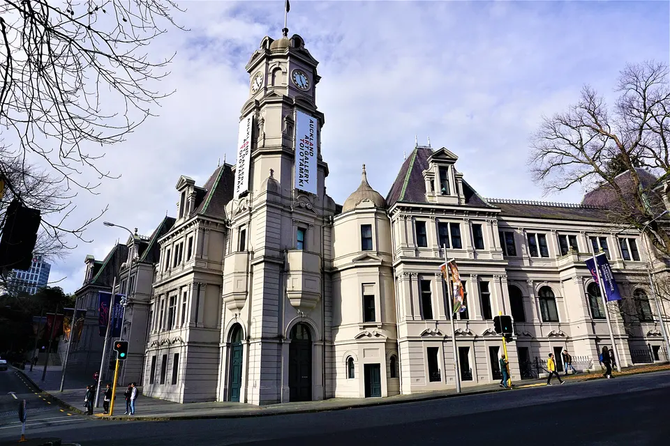
Walk up Maungawhau for the crater and the view of both harbours, cross the Domain to the Auckland Museum for the meeting house and the war memorial, come downtown for the free galleries of Toi o Tāmaki and Albert Park, go up the Sky Tower before the lights come on, and eat by the boats at the Viaduct.

  • 6 sights
  • 4.8 km on foot
  • Longest walk 2.3 km
1234561 kmN
Stops in order, straight-line distancesRoute in Google Maps ↗

Morning

Maungawhau / Mount Eden
Photo: Avenue, CC BY-SA 3.0
1Volcanic cone

Maungawhau / Mount Eden

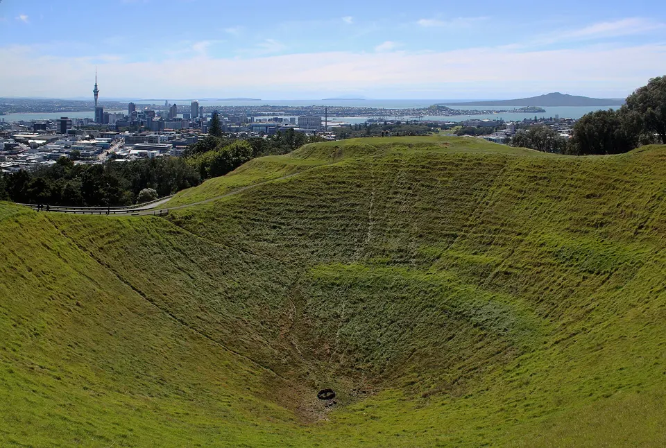
The highest natural point of the isthmus at 196 metres, a 28,000-year-old scoria cone with a perfect 50-metre-deep bowl of a crater, terraced by the Māori pā that stood here from the 15th century and looked over both the Waitematā and Manukau harbours, gives the best free view in the city: the Sky Tower, the bridge, Rangitoto in the gulf and the whole chain of the other cones. The summit road has been closed to cars since 2016 and the walk from the Puhi Huia Road gate is about 15 minutes; the tihi, the summit and crater, are sacred to the iwi who co-govern the maunga and are not to be walked on. Go early, when the light is behind you and the tour vans have not come.

  • Plan about 1 h 15 min
  • Free; gates open 7:00–20:30 in summer and 7:00–19:00 in winter; no vehicles to the summit; keep off the crater and the tihi
2.3 km · about 36 min on foot
Auckland War Memorial Museum Tāmaki Paenga Hira
Photo: Daan Hoffmann / Auckland War Memorial Museum, CC BY 2.0
2Museum

Auckland War Memorial Museum Tāmaki Paenga Hira

On the top of the Domain, the neoclassical memorial of 1929 to the dead of the First World War holds the country's first museum and the world's largest collection of Māori and Pacific treasures: the ground floor's Māori Court with the 25-metre war canoe Te Toki-a-Tāpiri, carved in the 1830s, and the meeting house Hotunui of 1878, which you may enter barefoot; the Pacific galleries; a natural-history floor with a moa and the volcano gallery that simulates an eruption under the harbour; and the top-floor war memorial galleries and Hall of Memories. The Māori cultural performance of songs, poi and haka runs several times a day for a separate ticket, and the Tuesday late opening is the quiet time.

  • Plan about 2 h 30 min
  • Mon–Fri 10:00–17:00, Sat–Sun 9:00–17:00, Tue until 20:30; NZ$32 international adults, NZ$16 children 5–15, family NZ$86; free for Auckland residents with proof of address
240 m · about 4 min on foot
Auckland Domain and the Wintergardens
Photo: Francesco Bini, CC BY-SA 4.0
3Park

Auckland Domain and the Wintergardens

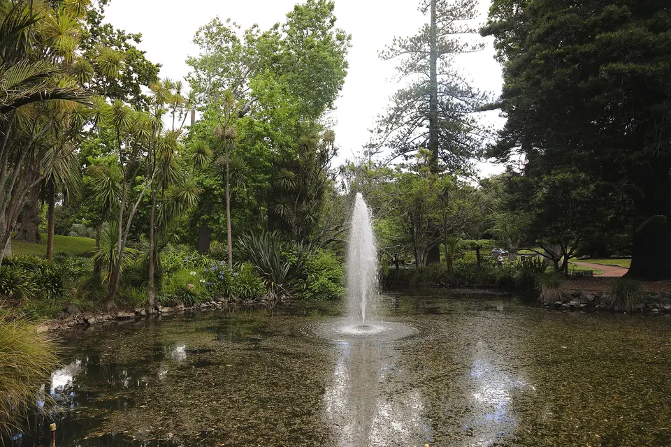
The city's oldest park, 75 hectares of lawns, duck ponds and native bush inside the crater of the Pukekawa volcano, wraps around the museum and gives the walk back into the city: from the museum steps down past the cricket ground to the Wintergardens, two barrel-vaulted Edwardian glasshouses of 1921 and 1928 around a courtyard of lily ponds, one temperate and one tropical, restored in 2024 and free, with a fernery in the old quarry behind them, then out through the Parnell gates or the Grafton Bridge to the university and Albert Park. It is where Aucklanders run at dawn and picnic on Sundays.

  • Plan about 45 min
  • Free; Wintergardens open daily about 9:00–17:30 in summer and 9:00–16:30 in winter

Midday

LunchLunch is in Parnell, ten minutes downhill from the museum, where the cafés of Parnell Road do the flat whites, pies and big brunches Auckland lives on, or in the Wintergardens café in the Domain itself; back in the city, the food courts of Commercial Bay and the dumpling houses of Dominion Road are the cheap and quick alternatives. Eat by 13:00 to give the gallery and the tower their afternoon.

Afternoon

1.2 km · about 19 min on foot
470 m · about 7 min on foot
Sky Tower
Photo: Marco Klapper, CC BY 2.0
5Observation tower

Sky Tower

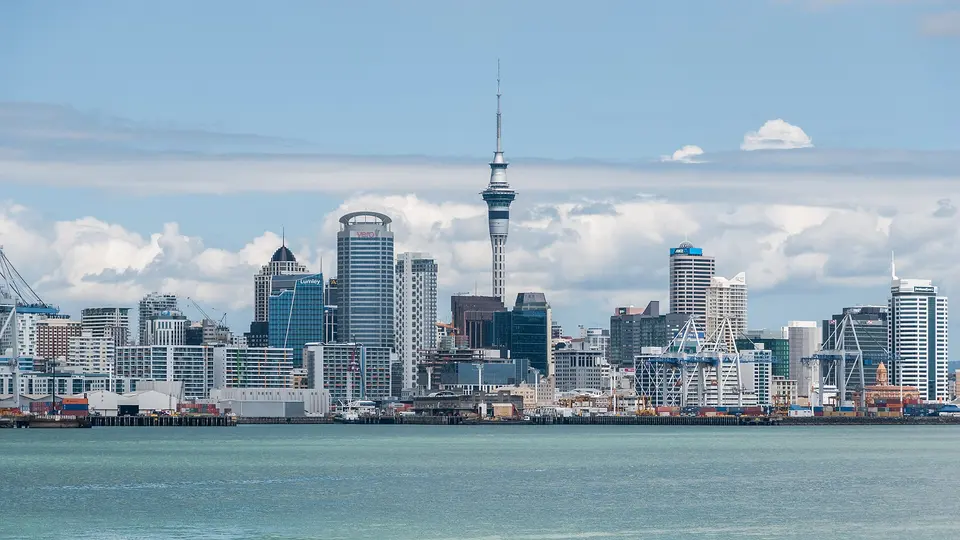
The 328-metre concrete needle of 1997 is the tallest freestanding structure in the southern hemisphere and the city's compass point from every direction: the lifts take 40 seconds to the main observation deck at 186 metres, with glass floor panels and the volcanoes, the harbours and Rangitoto laid out in every direction, and to the Sky Deck at 220 metres, and the SkyWalk and SkyJump take people around and off the outside on wires for a good deal more money. Go up in the last hour of daylight to get the city by day and by night for one ticket, and book the slot online to skip the queue.

  • Plan about 1 h 15 min
  • Open daily into the evening; general admission about NZ$40 adults, NZ$20 children 6–14, under 6 free; SkyWalk and SkyJump extra

Evening

590 m · about 9 min on foot
Viaduct Harbour and Wynyard Quarter
Photo: Radosław Botev, CC BY 3.0 pl
6Waterfront

Viaduct Harbour and Wynyard Quarter

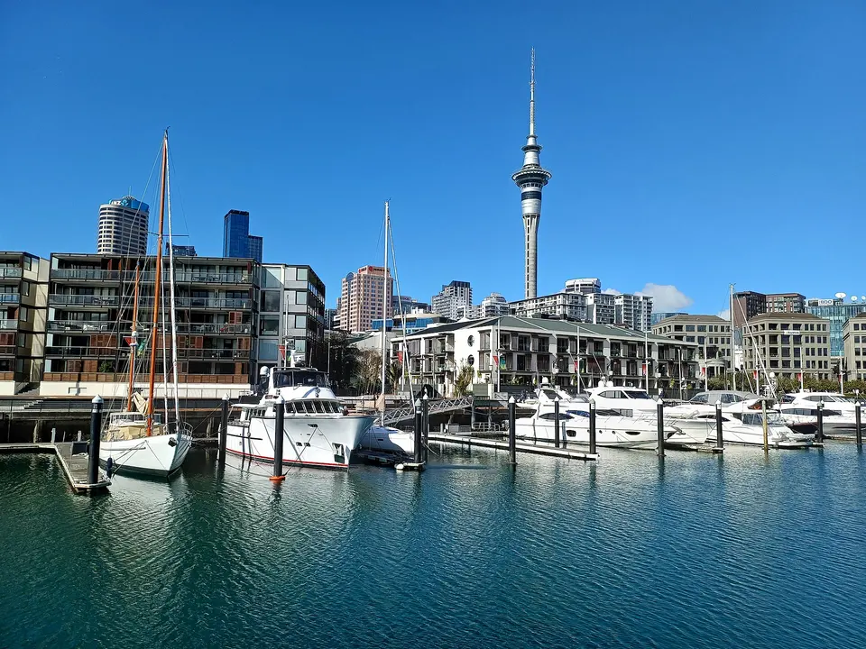
The old fishing harbour rebuilt for the America's Cup defences of 2000 and 2003 is the city's evening room, a basin of superyachts ringed by bars and seafood restaurants, with the Maritime Museum and its heritage sailings at one end and the Wynyard Crossing bascule bridge at the other leading over to Wynyard Quarter, the former tank farm turned into a waterfront of playgrounds, the fish market and a wider, cheaper choice of places to eat, with the Silo Park cinema on summer nights. Walk the whole loop along the water from the Ferry Building to the Silos as the lights come on.

  • Plan about 2 h
  • Free; bars and restaurants open late; the Wynyard Crossing bridge lifts for boats, allow a few minutes

Day 2

Waiheke Island: Oneroa, the vineyards and Onetangi, then Ponsonby

Take a mid-morning ferry across the gulf to Waiheke, walk from the wharf to the village and beach of Oneroa, eat a long lunch among the vines with the city on the horizon, spend the afternoon on the two kilometres of Onetangi beach, and ride the ferry back for dinner on Ponsonby Road.

  • 4 sights
  • Transport between sights
12345 kmN
Stops in order, straight-line distancesDriving route in Google Maps ↗

Morning

Oneroa
Photo: AlasdairW, CC BY-SA 4.0
1Beach village

Oneroa

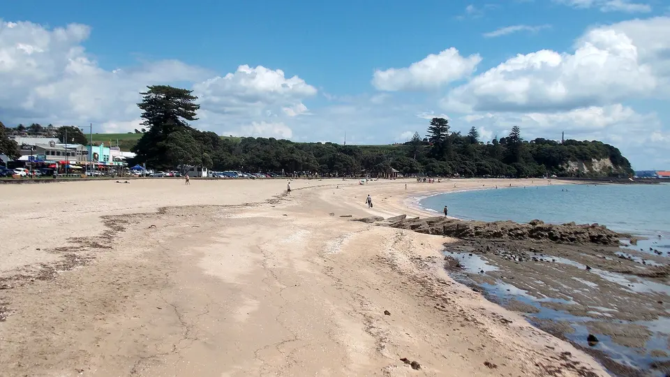
Waiheke's main village, 25 minutes on foot from the Matiatia ferry wharf along a coastal path of pōhutukawa and coves or five minutes by bus, is a single street of galleries, cafés and the island's only supermarket on a ridge above a crescent of white sand where the water is calm and swimmable from November to April and the view runs back across the gulf to the city; the smaller Little Oneroa beside it has a playground and the fish-and-chip shop. It is the base for the day: buy water and fruit here, and come back for the shops before the ferry if you want.

  • Plan about 1 h 30 min
  • Free; ferry to Matiatia about 40 minutes, then bus 50A/50B or a 25-minute walk; beach unpatrolled outside summer

Midday

LunchWaiheke's lunch is a vineyard: Mudbrick, Cable Bay and Tantalus all do long lunches with a view of the city across the water, Mudbrick's the most photographed and the hardest to book, while the casual option is Casita Miro's tapas at Onetangi or fish and chips on Oneroa beach. Book the vineyard a week ahead in summer and give it two hours; the island runs on its own clock.

Afternoon

A 20-minute walk uphill from Oneroa village along Church Bay Road, or the Waiheke bus and a short walk; book the table
Mudbrick and the Church Bay vineyards
Photo: Mike Dickison, CC BY 4.0
2Vineyard

Mudbrick and the Church Bay vineyards

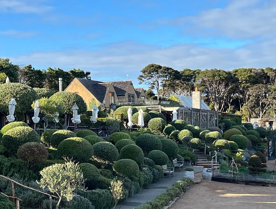
Waiheke's 30 wineries grow Bordeaux reds, syrah and chardonnay on the hills of an island with its own warm microclimate, and the ones on the western end, Mudbrick, Cable Bay, Tantalus and Jurassic Ridge, are within a 20-minute walk of Oneroa and sit on ridges that look straight back at the Sky Tower across the water; Mudbrick's stone buildings, lavender terraces and restaurant are the postcard, and its cellar door pours tastings for those not staying for lunch. Tastings are paid and refunded against bottles; lunch bookings go weeks ahead in summer and the island's Waiheke Wine tour buses do the driving for anyone tasting seriously.

  • Plan about 2 h 30 min
  • Cellar doors open daily from about 11:00, tastings paid; lunch by reservation; a 20-minute uphill walk from Oneroa village
Bus 50A/50B from Oneroa or the vineyard's gate along the spine of the island, about 20 minutes; the island's buses take AT HOP and contactless cards
Onetangi Beach
Photo: AlasdairW, CC BY-SA 3.0
3Beach

Onetangi Beach

The island's longest beach, almost two kilometres of pale sand on the north coast with a road of baches and a couple of restaurants behind it, faces the gulf islands and has room for everyone even on a summer Sunday, with gentle surf, shade under the pōhutukawa at the eastern end and Charlie Farley's and the Onetangi Hotel for a beer with sand on your feet; the Onetangi beach races, horses and tractors on the sand, are a February institution. The bus from Oneroa takes 20 minutes and the last ferry-connecting buses leave around dusk.

  • Plan about 2 h
  • Free; bus 50A/50B from Oneroa, about 20 minutes; restaurants and a store at the western end

Evening

Bus back to Matiatia, ferry to the city, then the Inner Link or Outer Link bus from Customs Street up to Three Lamps, about 15 minutes, or a 25-minute walk up Franklin Road
Ponsonby Road
Photo: AnnWoolliams, CC BY-SA 4.0
4Restaurant and bar street

Ponsonby Road

The ridge road two kilometres west of the centre, lined with Victorian villas and shopfronts that went from working-class Pacific neighbourhood to the city's best-dressed street, is where Auckland eats and drinks out: Ponsonby Central's food hall and rooftop, the wine bars and dumpling rooms between Three Lamps and Karangahape Road, and the K Road end itself, with its bars, live music and the pink Rainbow Bridge over the motorway. The Inner Link bus runs the loop from the city; walk it from Three Lamps south and pick the place with the queue.

  • Plan about 2 h
  • Free; restaurants and bars open late; Inner Link and Outer Link buses from Customs Street to Three Lamps

Day 3

Rangitoto and the North Shore: the summit track, Devonport and Mt Victoria, then Mission Bay

Catch the morning ferry to Rangitoto, walk up through the lava fields and the pōhutukawa forest to the crater rim for the view back over the city, ferry to Devonport for fish and chips and the villas, climb Takarunga / Mt Victoria for the harbour, and end with the sunset on the beach at Mission Bay.

  • 4 sights
  • Transport between sights
12342 kmN
Stops in order, straight-line distancesDriving route in Google Maps ↗

Morning

Rangitoto Island
Photo: Duncnbiscuit, CC BY-SA 4.0
1Volcanic island

Rangitoto Island

The youngest and largest of the volcanoes, a symmetrical 260-metre shield that rose out of the gulf in a series of eruptions about 600 years ago, watched by the Māori living on the neighbouring island, is a scenic reserve of black lava fields, lava caves and the world's largest pōhutukawa forest, pest-free since 2011 and home again to saddlebacks and kākāriki; the Summit Track from Rangitoto Wharf climbs 2.3 km in about an hour through the scoria and the forest to the crater rim, where the whole of Auckland and the gulf are laid out, and the return by the same track or the lava caves loop takes two to three hours in all. There is no shop, no water, no shade on the lava and no way off but the ferry, so carry everything and be back for the sailing you booked.

  • Plan about 4 h
  • Ferry NZ$55 adult return, NZ$25 children 5–15, departing 9:30 weekdays and 9:15 weekends, about 25 minutes; summit walk 2–3 hours return; pest-free island, check shoes and bags, no food to be left

Midday

LunchThere is nothing to eat on Rangitoto, so either carry lunch up the volcano or hold out for Devonport, where the fish and chips of the Victoria Road shops are eaten on the wharf, and the cafés and pubs along the street do a late lunch until mid-afternoon. The Devonport ferry from Rangitoto lands you at the bottom of the main street.

Afternoon

Fullers360 ferry from Rangitoto back via Devonport in the early afternoon, or return to the city and take the Devonport ferry, 12 minutes, every 30 minutes
Devonport
Photo: DXR, CC BY-SA 4.0
2Harbour village

Devonport

Across the harbour on the North Shore, twelve minutes by ferry, Devonport is the city's oldest suburb and the base of the navy, a village of white Victorian villas, bookshops and cafés on Victoria Road that ends at a wharf and a beach with the whole skyline across the water, and two volcanic cones, Takarunga and Maungauika / North Head with its tunnels and gun emplacements over the harbour entrance; the Sunday market, the naval museum at Torpedo Bay and the fish and chips on the wharf fill an afternoon, and the ferry back at dusk is the best view of the city's lights.

  • Plan about 1 h 30 min
  • Free; Fullers360 ferry from the Downtown Ferry Terminal, 12 minutes, every 30 minutes, about NZ$8 with a card; Sunday market
A 15-minute walk from the Devonport wharf up Victoria Road and Kerr Street
Takarunga / Mount Victoria
Photo: Danny William Wilson, CC BY-SA 4.0
3Volcanic cone

Takarunga / Mount Victoria

The 87-metre cone above Devonport, terraced by a large Māori pā and topped with a signal station, a 19th-century disappearing gun and a cluster of mushroom-shaped ventilation shafts painted by local children, is a 15-minute walk from the wharf and the finest short climb in the city: Rangitoto floats in the gulf to the east, the harbour bridge and the city fill the south, and the ferries cross below. The road to the top is closed to cars, as on all the maunga, and the summit is asked to be respected.

  • Plan about 45 min
  • Free; 15-minute walk from Devonport wharf via Kerr Street; summit road closed to vehicles

Evening

Ferry to the city, 12 minutes, then the Tāmaki Link bus from Britomart along Tamaki Drive, about 25 minutes, or a bike on the waterfront path
Mission Bay
Photo: gérard, CC BY-SA 2.0
4Beach

Mission Bay

The city's own beach, 7 km east along Tamaki Drive, is a wide arc of golden sand facing Rangitoto with a lawn, a 1950s Art Deco fountain that lights up at night, a strip of restaurants, ice-cream parlours and the Mission Bay Pavilion, and a waterfront path that runs the whole way from the city past Ōkahu Bay and Kelly Tarlton's; Aucklanders come for the evening swim and the sunset behind the city, and the Tāmaki Link bus or a hired bike gets you here in 25 minutes. Fish and chips on the grass as the fountain comes on is the end of the trip.

  • Plan about 2 h
  • Free; Tāmaki Link bus from Britomart along Tamaki Drive, about 25 minutes; restaurants open late

Good to know in Auckland

Tickets and opening days

  • Auckland War Memorial Museum is open 10:00 to 17:00 on weekdays and 9:00 to 17:00 at weekends, and late until 20:30 every Tuesday; general admission for international visitors is NZ$32 for adults, NZ$16 for children aged 5 to 15, free under 5 and NZ$86 for a family of two adults and two children, while Auckland residents enter free with proof of address and other New Zealand residents by donation; charges may apply for some special exhibitions, events and experiences.Source: Auckland Museum, hours and admission · checked Sep 2026
  • Auckland Art Gallery Toi o Tāmaki is open every day from 10:00 to 17:00 except Christmas Day, and admission to its general collection exhibitions is free for all; the main entrance is at 1 Kitchener Street, on the corner of Wellesley Street East.Source: Auckland Art Gallery, visit · checked Sep 2026
  • Fullers360 ferries to Waiheke leave from Piers 11 and 12 at the Downtown Ferry Terminal, 99 Quay Street, with up to 22 sailings on peak days from 6:00 on weekdays and 7:00 at weekends until about 23:45, a crossing of about 40 to 45 minutes; adult return fares are NZ$62 walk-up and NZ$46.50 off-peak, and child fares (5–15) NZ$28 and NZ$21.Source: Fullers360, Waiheke Island · checked Sep 2026
  • The Fullers360 ferry from Auckland to Rangitoto Island takes about 25 minutes and costs NZ$55 return for adults and NZ$25 for children aged 5 to 15, departing at 9:30 and 10:30 on weekdays and 9:15 and 10:30 at weekends and public holidays, with early sailings via Devonport; the summit walk of 2.3 km from the wharf takes about an hour up and two to three hours for the round trip.Source: Fullers360, Rangitoto Island · checked Sep 2026
  • The summit road and the tihi (summit) of Maungawhau / Mt Eden have been permanently closed to private motor vehicles, including motorbikes and scooters, since January 2016; the maunga is open 7:00 to 20:30 in summer and 7:00 to 19:00 in winter.Source: Tūpuna Maunga Authority, Maungawhau · checked Sep 2026

3 days in Auckland: quick answers

Is 3 days enough for Auckland?

Three days cover the city, the museum, Waiheke and Rangitoto. A fourth day with a car is the west coast: the Waitākere Ranges Regional Park with the Arataki Visitor Centre, the black-sand surf beach of Piha under Lion Rock and the walk to Kitekite Falls, or Muriwai's gannet colony from August to March; without a car it is the Māori and Pacific performances back at the museum, Kelly Tarlton's aquarium on Tamaki Drive, MOTAT and the zoo at Western Springs, or the bird sanctuary of Tiritiri Matangi by ferry. Kauri dieback closes some Waitākere tracks; check Auckland Council's list and use the cleaning stations.

Which days should I plan around?

The Auckland Museum is open 10:00 to 17:00 on weekdays, 9:00 to 17:00 at weekends and until 20:30 on Tuesdays. The Art Gallery is open every day 10:00 to 17:00 except Christmas Day. The Sky Tower is open daily into the evening. Waiheke ferries run from 6:00 on weekdays and 7:00 at weekends until late; the Rangitoto ferry has only morning departures and set return times, so it is a day with a timetable. Maungawhau's gates are open 7:00 to 20:30 in summer and 7:00 to 19:00 in winter. Weekends fill the Waiheke ferries and vineyards, so book the lunch and take an early boat.

How much do the tickets cost?

The Auckland Museum is NZ$32 for international adults, NZ$16 for children 5 to 15 and NZ$86 for a family, free for Auckland residents and by donation for other New Zealanders. The Art Gallery's collection is free. The Sky Tower is about NZ$40 for adults and NZ$20 for children 6 to 14. The Waiheke ferry is NZ$62 return for adults at peak times and NZ$46.50 off-peak, NZ$28 and NZ$21 for children. The Rangitoto ferry is NZ$55 return for adults and NZ$25 for children, and the island is free. The Devonport ferry is around NZ$8 each way with a card. Maungawhau, the Domain, the beaches and Mt Victoria are free.

How do I get around?

By bus and ferry with a contactless bank card or an AT HOP card, tapped on and off: a single fare is a few dollars, and contactless payments are capped at NZ$20 a day across buses, trains and the inner-harbour ferries, with cash fares higher; the Waiheke ferry is separate and bought from Fullers360 or Island Direct. The City Link and Inner Link buses loop the centre and Ponsonby, the Tāmaki Link runs the waterfront to Mission Bay, and the Downtown Ferry Terminal on Quay Street is the hub for every island. The airport is 21 km south, 45 to 60 minutes by the AirportLink bus and train or by taxi. A car is only needed for the west coast.

What are the rules on the maunga and the islands?

Maungawhau's summit road has been closed to private vehicles since 2016 and the tihi, the summit, is walked to and looked from but not walked on: the Tūpuna Maunga Authority asks visitors to keep off the crater and the summit cone, which are sacred to mana whenua. Rangitoto is a pest-free sanctuary: check your bag and shoes for soil and seeds before the ferry, leave no food, stay on the tracks and take everything home. Waiheke's beaches have no lifeguards outside summer and the island's roads are narrow, so the bus is easier than a hired car.

How much walking is this itinerary?

About 8 km on day one, including the climb of Maungawhau and the walk down through the Domain into the city; about 5 km on day two on Waiheke, mostly the coastal path to Oneroa and the beach, less if you take the bus; and about 8 km on day three, with the 2.3 km Rangitoto summit track each way on rough lava and the short climb of Mt Victoria. Paths are good but the volcano tracks are hot and shadeless in summer and the weather turns fast; take a layer, a hat and water everywhere.

Other Auckland itineraries

Keep exploring

Where this connects

THE TRIPWOA APP

Go somewhere.
Make it yours.

Build days around what you love. Follow your route, find your next stop and keep the moments along the way.

Get it on Google PlayAvailable for Android
Free to start
Tripwoa home with a Paris trip and nearby places to explore
Tripwoa day plan for New York with a route map and Times Square stop

A day that feels like you.

Sources and method

Places and coordinates: Wikidata and Tripwoa's open-data place catalog (Overture Maps Foundation, © OpenStreetMap contributors). Photos: Wikimedia Commons, credited on each image. Practical rules: the official sources linked in each note, checked in September 2026.

How this plan was made: Tripwoa's planner drafted the day order from real coordinates and typical visit times. Each stop was then reviewed, reordered where needed and rewritten with AI assistance. Walking distances are straight-line estimates, so allow a little extra time on real streets.