3-day itinerary · New Zealand

3 Days in Queenstown

A realistic first-timer plan that takes the gondola up Bob's Peak on day one for the view that made the town, crosses the lake on the coal-fired TSS Earnslaw to the sheep station at Walter Peak, walks the peninsula of the Queenstown Gardens and ends on the waterfront with the burger the whole country queues for; drives on day two to the gold-rush village of Arrowtown and the huts of its Chinese miners, watches the jumpers at the Kawarau Bridge where bungy began, tastes pinot noir in the Gibbston Valley and takes the jet boat through the Shotover canyon; and gives day three, all of it, to the road and the fiord of Milford Sound, by coach or car through Te Anau, the Eglinton Valley and the Homer Tunnel to the cruise under Mitre Peak. Every stop comes with the prices, the booking rules and the weather warnings that matter in 2026.

  • 3days
  • 13sights
  • 0.0 kmon foot between sights

Updated 12 September 2026 · 5 official sources checked · report an error

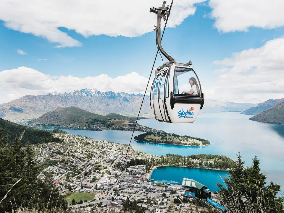
Skyline gondola and Bob's Peak
Photo: Skyline Enterprises NZ, CC BY-SA 4.0

The gondola, the steamer and the lake, then Arrowtown, the bungy and the wine, then Milford Sound

Queenstown's centre is a few streets between the lake and the gondola, and day one is walked from it. Day two loops 60 km through Arrowtown, the Kawarau Gorge and Arthurs Point, by hired car, the Orbus bus for Arrowtown or the operators' shuttles, which collect from town. Day three is Milford Sound, 290 km each way, a 12-hour day by coach and cruise or a long drive with an early start, and the weather decides it: the road closes for snow and avalanche in winter, the fiord is best in rain, and fog closes the flights. Everything here is booked ahead in the summer months from December to February and in the ski season from June to September, when the town is full; the gondola, the steamer and the Milford cruises sell out on fine days. Bring layers in every season; the mountain weather changes by the hour.

At a glance

Ways to use these days

Outdoors
Queenstown Gardens · Queenstown Bay and Steamer Wharf
Lightest day on foot
Day 1 — 26.5 km between stops
Most walking
Day 3 — 96.7 km

Day 1

The lake and the peak: the Skyline gondola, the TSS Earnslaw to Walter Peak, the Queenstown Gardens and the waterfront

Ride the gondola up Bob's Peak first thing for the view over the lake and the Remarkables, and walk the Tiki Trail or a stretch toward Ben Lomond if you have legs for it, cross the lake in the afternoon on the 1912 steamship to the sheep station at Walter Peak, walk the Queenstown Gardens on the peninsula, and end on the waterfront at Steamer Wharf with the crowd.

  • 4 sights
  • Transport between sights
12345 kmN
Stops in order, straight-line distancesDriving route in Google Maps ↗

Morning

Skyline gondola and Bob's Peak
Photo: Skyline Enterprises NZ, CC BY-SA 4.0
1Gondola and viewpoint

Skyline gondola and Bob's Peak

The gondola that climbs 450 metres from Brecon Street to the top of Bob's Peak in a few minutes, rebuilt in 2024 with ten-seat cabins and a new terminal, delivers the view that sells the town: the lake in its lightning-bolt shape, Cecil and Walter peaks across it, the Remarkables in a wall to the east and the town on its bay below; up top are the luge tracks, the restaurant with the stargazing, the paragliders launching from the slope, the Skyline mountain-bike park and the start of the Tiki Trail down and the Ben Lomond track up to the saddle, two to three hours of climbing through beech forest for the alpine view. Go up in the morning when the light is on the lake and the cabins are empty.

  • Plan about 2 h 30 min
  • Daily from 9:00 or 10:00, closing by season; gondola about NZ$33 adults, NZ$21 children 6–14, family about NZ$90; gondola and five luge rides about NZ$55/45; book online

Midday

LunchLunch is the town's ritual: Fergburger on Shotover Street, where the queue runs down the pavement for a half-kilo burger since 2001, and its bakery and ice-cream shop next door, or, if the queue is too much, the Devil Burger round the corner, the pies of the Fergbaker, or a plate of fish at the lakefront bars. Eat by 12:30 to make the afternoon sailing; the Earnslaw's own dining room is at Walter Peak.

Afternoon

The TSS Earnslaw sails from Steamer Wharf on Beach Street, a 10-minute walk from the gondola base; the crossing is 40 minutes each way
TSS Earnslaw and Walter Peak
Photo: Bernard Spragg, CC0
2Steamship cruise and farm

TSS Earnslaw and Walter Peak

The Lady of the Lake, the twin-screw coal-fired steamer launched in 1912 the same year as the Titanic and the last of her kind in the southern hemisphere, sails several times a day from Steamer Wharf across the lake to Walter Peak High Country Farm, 40 minutes each way, with the engine room open to passengers and a pianist in the saloon; at the farm, a lakeside homestead of 1860s sheep-station gardens under the 1,800-metre peak, the tour shows sheepdogs working, a shearing and the animals of the station, and there is a lunch or a barbecue in the old homestead for those who book the farm option. It is old-fashioned, expensive and the thing everyone remembers.

  • Plan about 3 h 30 min
  • Several sailings daily, 90-minute cruise from NZ$115, cruise with the farm tour from NZ$139; book ahead in summer; annual survey closure in winter
A 5-minute walk from Steamer Wharf around the bay to the peninsula gate
Queenstown Gardens
Photo: Coekon, CC BY-SA 4.0
3Park

Queenstown Gardens

The peninsula that closes the town's bay on the south, laid out in 1867 with the exotic trees of a Victorian park, sequoias, oaks, a rose garden and a pond of ducks, is a 30-minute loop on flat paths along the water with the Remarkables straight ahead and the town behind, a frisbee-golf course through the trees, the ice rink and the bowling club at the neck, and benches at the point where the lake wind comes off the mountains; in autumn the colour of the poplars and in winter the snow on the range are the pictures. It is free and it is the town's quiet corner.

  • Plan about 1 h
  • Free, open all the time; a 5-minute walk from the wharf

Evening

A 5-minute walk back along the lakefront to Steamer Wharf and the Mall
Queenstown Bay and Steamer Wharf
Photo: Bernard Spragg, CC0
4Waterfront

Queenstown Bay and Steamer Wharf

The waterfront from the wharf along Marine Parade, the beach of the bay, the Mall and the lanes of Cow Lane and Searle Lane behind it, is where the town lives in the evening: the bars of Steamer Wharf over the water, the buskers on the Village Green, the ice cream at Patagonia, the line at Fergburger, the ducks and the eels under the jetty and the Remarkables going pink over the lake, and, after dark, the lanes' bars and clubs that are the reason half the visitors came; the Earnslaw's coal smoke and the paragliders landing on the beach are part of the scene. Sit on the rocks by the jetty at sunset.

  • Plan about 2 h
  • Free; bars and restaurants until late, many booked in season

Day 2

Gold, bungy and wine: Arrowtown, the Chinese settlement, the Kawarau Bridge, the Gibbston Valley and the Shotover Jet

Drive out to Arrowtown for the stone cottages of the 1862 gold rush and the huts of its Chinese miners by the river, on to the Kawarau Gorge to watch the jumpers, or jump, at the bridge where bungy started in 1988, taste the pinot noir of the Gibbston Valley in its cellar cave, and come back through Arthurs Point for the jet boat through the canyon of the Shotover.

  • 5 sights
  • Transport between sights
123455 kmN
Stops in order, straight-line distancesDriving route in Google Maps ↗

Morning

Arrowtown
Photo: Tony Hisgett, CC BY 2.0
1Gold-rush village

Arrowtown

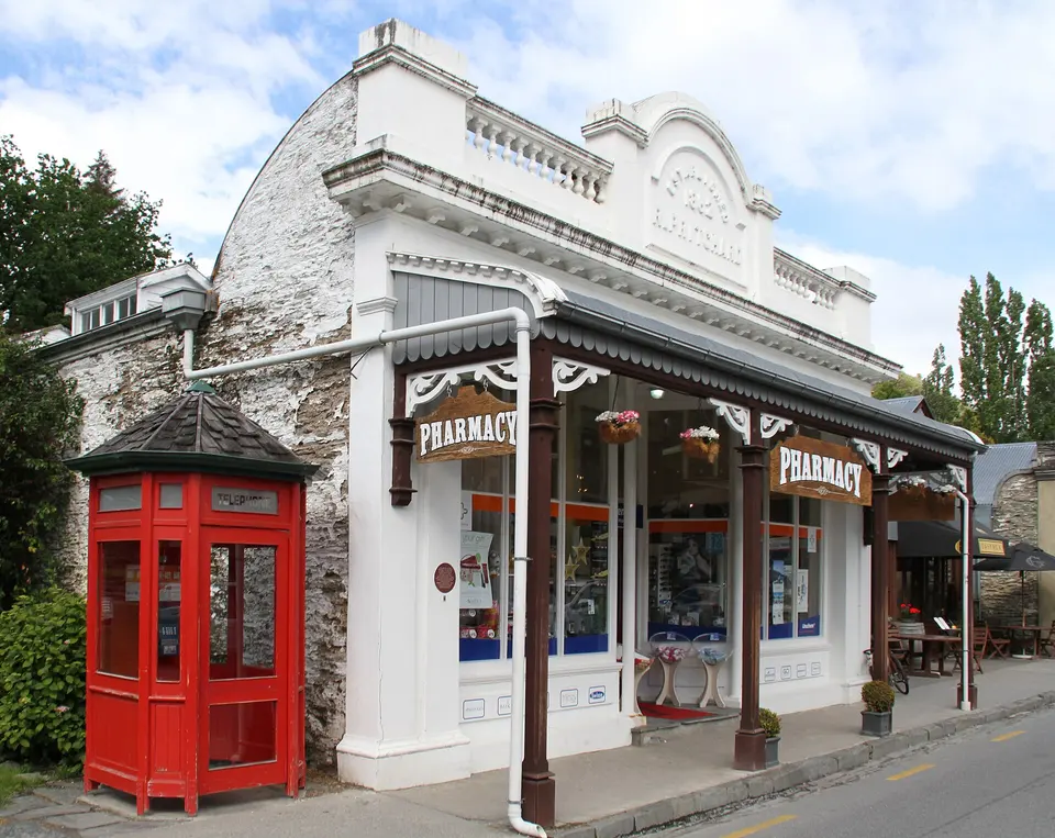
The village that grew in weeks when gold was found in the Arrow River in 1862 kept its main street of miners' cottages, stone and timber shopfronts and sycamores, now cafés, galleries, a cinema and the Lakes District Museum in the old bank, which tells the rush and rents gold pans for the river; the avenue of trees turns gold in April for the autumn festival, the river walk runs down to the Chinese settlement, and the hills around it are the Lord of the Rings' Ford of Bruinen. It is 20 km from the town and worth the whole morning, before the tour buses at 11:00.

  • Plan about 2 h
  • Streets free; Lakes District Museum daily 9:00–17:00 (closed Christmas Day), NZ$14 adults, NZ$6 children, NZ$12 seniors; Orbus bus 2
A 5-minute walk from Buckingham Street along the Arrow River
Arrowtown Chinese Settlement
Photo: Bernard Spragg, CC0
2Historic site

Arrowtown Chinese Settlement

On the riverbank at the end of Buckingham Street, the restored huts of stone and mud, some no bigger than a bed, and Ah Lum's store are what remains of the settlement of Chinese miners who were invited to Otago in the 1860s to rework the abandoned claims, lived apart by law and prejudice, sent their gold and their bones home, and numbered 60 here at the peak; the Department of Conservation restored the site in the 1980s with panels that tell the story plainly, and it is free, quiet and ten minutes from the cafés. The river path continues from it into the gorge.

  • Plan about 45 min
  • Free, open all the time; a 5-minute walk from the museum

Midday

LunchArrowtown's Buckingham Street has the cafés and the pubs for lunch, the Fork and Tap and the Chop Shop, and the bakery's pies, or hold out for the Gibbston Valley: the winery's restaurant does a two-course lunch with the cave tour, and the cheesery next door sells a picnic of its own cheeses to eat among the vines. Book the winery lunch; on summer weekends it is full.

Afternoon

Car 15 minutes south-east on the Gibbston highway; the bungy centre has a viewing platform and café
Kawarau Gorge Suspension Bridge (bungy)
Photo: sussexbirder, CC BY 2.0
3Historic bridge and bungy site

Kawarau Gorge Suspension Bridge (bungy)

The 1880 suspension bridge over the turquoise Kawarau River in its gorge, 43 metres above the water, is where AJ Hackett and Henry van Asch opened the world's first commercial bungy jump in November 1988, and it still runs, with jumpers dunked to the shoulders in the river on request, tandem jumps, a zipride down the gorge and, at the centre on the bank, a viewing deck, a café and a bar where the rest of the world watches for free; the Nevis, the 134-metre jump on a cable car over a canyon 30 minutes further, is the big one. Booking ahead is needed in summer; the bridge itself is a heritage reserve and walkable.

  • Plan about 1 h 15 min
  • Daily; bungy about NZ$175, watching free; viewing deck and café; 23 km from town on the Gibbston highway
Car 10 minutes east along the same highway; the winery is at the Gibbston Valley Village
Gibbston Valley wineries
Photo: tjabeljan, CC BY 2.0
4Wine region

Gibbston Valley wineries

The Valley of the Vines, the narrow gorge of the Kawarau east of the bridge, is the southernmost wine region in the world and Central Otago's original, planted from the 1980s against all advice with the pinot noir that won it a name, and its dozen wineries along the highway, Gibbston Valley with its wine cave dug into the schist, Peregrine under its wing-shaped roof, Chard Farm on its cliff road, Waitiri Creek in an old church, pour tastings, sell lunches and rent bicycles for the Gibbston River Trail between them; the cave tour with three tastings is the short version and the winery lunch the long one. Drivers taste little; the wine tour buses and the trail exist for that reason.

  • Plan about 2 h
  • Cellar doors daily about 10:00–17:00; Gibbston Valley cave tour with tastings about NZ$28; lunch by booking; the Queenstown Trail links the wineries by bike

Evening

Car 25 minutes back west through Arrowtown to Arthurs Point; the Shotover Jet's own shuttle runs from the Station building in town every hour if you have no car
Shotover Jet at Arthurs Point
Photo: Bernard Spragg, CC0
5Jet boat ride

Shotover Jet at Arthurs Point

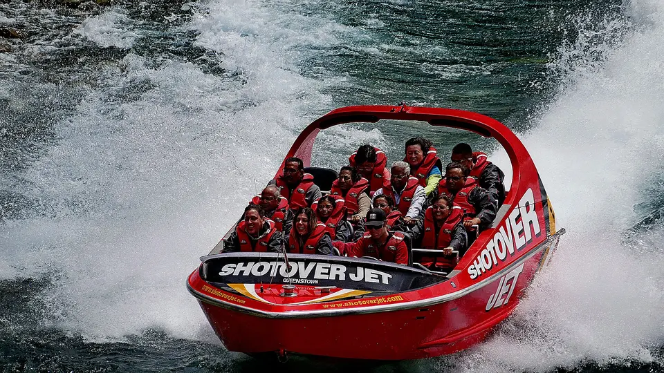
From the beach below the Edith Cavell bridge at Arthurs Point, 7 km north of town, the red jet boats have run the Shotover canyon since 1970 in 25 minutes of 85 km/h passes within centimetres of the rock walls, 360-degree spins and spray in the river that gave up more gold than any other in the country; it is the ride the Queen and the royals have taken, the minimum height is 1.2 metres, the boats run through the day and the company's shuttle collects from the Station building in town every hour. The Onsen hot pools on the cliff above, private cedar tubs looking down the river, are the evening after it, by reservation.

  • Plan about 1 h 30 min
  • Daily through the day; about NZ$159 adults, NZ$99 children, family pass NZ$507; minimum height 1.2 m; free shuttle from town

Day 3

The day to Milford Sound: Te Anau, the Eglinton Valley, the Homer Tunnel and the fiord

Leave at dawn by coach or car for the five-hour road to the fiord, with a stop at Te Anau on its lake, the flat gold grass of the Eglinton Valley and the Mirror Lakes, the avalanche gates of the Homer Tunnel, then a two-hour cruise on Milford Sound under Mitre Peak and its waterfalls, seals and, with luck, dolphins, and the long road back in the dusk.

  • 4 sights
  • Transport between sights
12345 kmN
Stops in order, straight-line distancesDriving route in Google Maps ↗

Morning

Te Anau
Photo: Tim Burgess, CC BY-SA 4.0
1Lakeside town

Te Anau

The town on the second-largest lake in the country, two hours from Queenstown, is the gateway to Fiordland National Park, the last fuel, café, bakery and supermarket before Milford, and the base for the Milford, Routeburn and Kepler tracks and the glow-worm caves across the water; the coach tours stop here for coffee and the drivers should too, since the 120 km ahead have nothing but the road, and the lake with the Murchison mountains behind it at 9:00 is worth the ten minutes on the shore. In the season the sandflies start here.

  • Plan about 45 min
  • Free; shops and cafés from early morning; the Fiordland visitor centre on the lakefront has the road and track status
Car 45 minutes north of Te Anau on the Milford road, State Highway 94; the Mirror Lakes boardwalk is a 5-minute stop
Eglinton Valley and the Mirror Lakes
Photo: Krzysztof Golik, CC BY-SA 4.0
2Glacial valley

Eglinton Valley and the Mirror Lakes

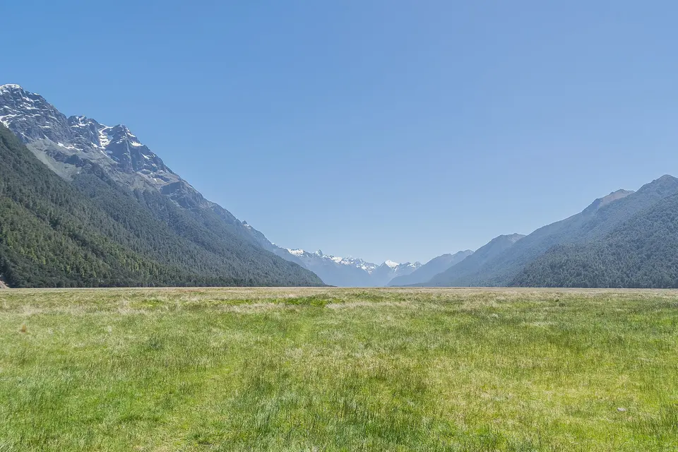
Forty minutes north of Te Anau the Milford road leaves the farmland and enters the national park along the floor of the Eglinton, a glacier-cut valley of golden tussock grass a kilometre wide between beech-forested walls, where the Mirror Lakes' boardwalk, a five-minute stop, reflects the Earl Mountains on a still morning, the Avenue of the Disappearing Mountain plays its trick, and the Knobs Flat shelter has the last toilets; it is the stretch of the road that the coaches slow down for and the drivers should stop on, and the first place the scale of Fiordland appears. Keas, the alpine parrots, wait at the car parks for anything left unattended.

  • Plan about 45 min
  • Free; Mirror Lakes car park and boardwalk on State Highway 94; no fuel or food on the road

Midday

LunchThere is no food beyond Te Anau except the terminal's café, so buy a picnic in Te Anau's bakeries and supermarket or choose a cruise with lunch on board, which the operators sell as an option; the coach tours include a stop and a cruise with a buffet or a picnic box. Eat on the water, with the waterfalls, since the ride back starts as soon as you land.

Afternoon

Car 45 minutes further through the Hollyford valley and the alpine climb; in winter the tunnel and the road are closed in avalanche conditions and chains are required
Homer Tunnel
Photo: edwin.11, CC BY 2.0
3Mountain pass and tunnel

Homer Tunnel

At the head of the Hollyford valley the road climbs into a granite cirque of waterfalls and snow and disappears into the 1.2-kilometre tunnel that relief workers began with picks in 1935 and finished in 1953, unlined, one lane with traffic lights in summer, dropping steeply on the far side into the Cleddau valley toward the fiord; the car park at the eastern portal is the place to stand in the cold under the walls, watch the keas take the windscreen wipers and understand why the road closes for avalanches from May to November, when chains are carried by law and the gates shut without warning. The Chasm, a short walk to a waterfall in a slot of rock, is ten minutes past it.

  • Plan about 30 min
  • Free; traffic-light one-way in summer; avalanche closures May–Nov, chains required in winter; check the road status
Car 20 minutes down the Cleddau valley to the terminal; park at the visitor centre car park and take the shuttle; be at the wharf 20 minutes before the cruise
Milford Sound / Piopiotahi
Photo: W. Bulach, CC BY-SA 4.0
4Fiord

Milford Sound / Piopiotahi

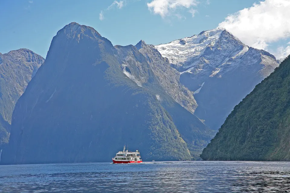
The fiord that Rudyard Kipling called the eighth wonder of the world is 15 km of black water between walls that rise 1,200 metres straight from the sea, with Mitre Peak the shape on every poster, the Bowen and Stirling falls dropping 160 metres onto the boats that nose under them, seals on the rocks, dolphins and the odd penguin, and, on the seven metres of rain that fall each year, a thousand temporary waterfalls that make a wet day the best day; the two-hour cruises leave from the terminal several times a day, the small boats get closest, the kayaks get quietest, and the underwater observatory on the shore shows the black coral that the fresh-water layer lets grow in the dark. It is 290 km from Queenstown and worth every one of them.

  • Plan about 2 h 30 min
  • Cruises daily about 10:30, 13:00 and 15:25, from NZ$175 adults; coach-and-cruise day from Queenstown about NZ$278/172, departing about 7:00; sandfly repellent and a rain jacket

Evening

DinnerThe coaches are back in Queenstown around 19:30 to 20:00 and the drivers about the same; the town eats late, so book a table on the waterfront or in the lanes for 20:30, at Botswana Butchery or Rātā for the occasion, the Cookie Time and the ice-cream on Beach Street for the walk home, and sleep.

Good to know in Queenstown

Tickets and opening days

  • The Ben Lomond Track from the Tiki Trail behind the Skyline Gondola base on Brecon Street is 14 km return and takes 6 to 8 hours, with 1,438 m of elevation gain from Queenstown, a steep gradient and high fitness required; the Department of Conservation warns that the weather changes rapidly and hypothermia is a real risk even in summer, that there are steep drop-offs near the summit, that mountain-bike tracks cross the walking track, and that walkers should leave enough daylight and pack a head torch.Source: Department of Conservation, Ben Lomond Track · checked Sep 2026
  • RealNZ's TSS Earnslaw steamship cruise across Lake Whakatipu is a 90-minute cruise from NZ$115, with cruises running regularly through the day from the RealNZ Visitor Centre at Steamer Wharf, 88 Beach Street; the cruise with the Walter Peak farm tour is from NZ$139.Source: RealNZ, TSS Earnslaw steamship cruises · checked Sep 2026
  • RealNZ's Milford Sound cruises depart daily at 10:30, 13:00 and 15:25, take up to two hours and are priced from NZ$175 for adults; the Milford Sound day trip from Queenstown departs daily at about 7:00.Source: RealNZ, Milford Sound cruises · checked Sep 2026
  • Orbus Queenstown bus fares are NZ$2.50 for adults with a Bee Card and NZ$4.00 in cash, NZ$1.50 for children aged 5 to 12 with a Bee Card and NZ$4.00 in cash; to and from Queenstown Airport the adult fare is NZ$2.50 with a Bee Card and NZ$10.00 in cash, and only cash or Bee Card is accepted on the airport route; the ferry is NZ$10.00 with a Bee Card and NZ$14.00 with a bank card.Source: Otago Regional Council, Queenstown fares and Bee Card · checked Sep 2026
  • The Lakes District Museum at 49 Buckingham Street, Arrowtown, is open Monday to Sunday 9:00 to 17:00 (closed Christmas Day); admission is NZ$14 for adults, NZ$12 for seniors 65+, NZ$10 for tertiary students, NZ$6 for school-age children, free under 5 and NZ$30 for a family of two adults and three children.Source: Lakes District Museum · checked Sep 2026

3 days in Queenstown: quick answers

Is 3 days enough for Queenstown?

Three days cover the town, the lake, the gold and wine country and the day to Milford Sound. A fourth day is Glenorchy, 45 minutes along the lake to the head of the water and the Dart River valley where the Lord of the Rings was filmed, with the Routeburn Track's first hours for walkers, or Wānaka over the Crown Range, or the full Ben Lomond climb, or the ski fields of Coronet Peak and the Remarkables from June to September, or the Onsen hot pools over the Shotover for the evening. Doubtful Sound, quieter and wilder than Milford, needs a whole day from Te Anau.

Which days should I plan around?

The gondola and the luge open every day from 9:00 or 10:00 with closing hours that change by season and weather; the TSS Earnslaw sails several times a day except during its annual survey in winter; the Milford cruises run daily with departures around 10:30, 13:00 and 15:25 and the coach tours from Queenstown leave about 7:00. The Lakes District Museum in Arrowtown is open daily 9:00 to 17:00 except Christmas Day. The Milford road can close without notice for snow and avalanche control from May to November, and the fiord is best in rain, when a thousand waterfalls run; check the road status the night before. Christmas to February and the July school holidays are the crowded weeks.

How much do the tickets cost?

The gondola is about NZ$33 for adults and NZ$21 for children, with the five-ride luge combo about NZ$55 and NZ$45. The TSS Earnslaw cruise is from NZ$115 and the cruise with the Walter Peak farm tour from NZ$139. The Kawarau Bridge bungy is about NZ$175 a jump and watching is free; the Shotover Jet about NZ$159 for adults and NZ$99 for children, with a family pass at NZ$507. The Gibbston Valley cave tour with tastings is about NZ$28. The Lakes District Museum is NZ$14, NZ$6 for children. The Milford Sound cruise from the wharf is from NZ$175, the coach-and-cruise day from Queenstown about NZ$278 for adults and NZ$172 for children. The gardens, the waterfront, Arrowtown's streets and the Chinese settlement, the Eglinton Valley and the Milford road are free.

How do I get around?

On foot in the centre and by the Orbus buses, NZ$2.50 with a Bee Card and NZ$4 cash, to Frankton, the airport and Arrowtown; the operators' shuttles collect from town for the jet boat, the bungy and the wineries; and a hired car from the airport, 8 km east, for the loop of day two and for Milford, though the coach-and-cruise tours do the Milford day without the 580 km of driving. In winter the roads need chains and the Crown Range and the Milford road close; in summer the car parks in town fill by 10:00. Bicycles ride the Queenstown Trail from the gardens to Arrowtown and the Gibbston wineries in a day.

What about the Ben Lomond track and the weather?

The Ben Lomond track, 14 km return from the gondola base with 1,438 metres of climb to the 1,748-metre summit, takes six to eight hours, is steep, exposed and crossed by mountain-bike trails, and the Department of Conservation rates it for high fitness with hypothermia a risk even in summer; the saddle at 1,316 metres, two to three hours up from the gondola top station, gives most of the view for half the effort. Everywhere here the weather turns in an hour: carry a rain shell, a warm layer, water and a headtorch, tell someone your plan, and turn back when the cloud comes down.

How much walking is this itinerary?

About 6 km on day one, most of it in the gardens and on the waterfront, more with the Tiki Trail down from the gondola or the walk toward the Ben Lomond saddle; about 4 km on day two through Arrowtown, along the river and among the vines; and about 3 km on day three, on the boardwalks and at the fiord, with 580 km of road. The paths are good, the sun is strong at this latitude, and the sandflies at Milford are real: cover up and carry repellent.

Other Queenstown itineraries

Keep exploring

Where this connects

THE TRIPWOA APP

Go somewhere.
Make it yours.

Build days around what you love. Follow your route, find your next stop and keep the moments along the way.

Get it on Google PlayAvailable for Android
Free to start
Tripwoa home with a Paris trip and nearby places to explore
Tripwoa day plan for New York with a route map and Times Square stop

A day that feels like you.

Sources and method

Places and coordinates: Wikidata and Tripwoa's open-data place catalog (Overture Maps Foundation, © OpenStreetMap contributors). Photos: Wikimedia Commons, credited on each image. Practical rules: the official sources linked in each note, checked in September 2026.

How this plan was made: Tripwoa's planner drafted the day order from real coordinates and typical visit times. Each stop was then reviewed, reordered where needed and rewritten with AI assistance. Walking distances are straight-line estimates, so allow a little extra time on real streets.