3-day itinerary · Peru

3 Days in Cusco

A realistic first-timer plan that keeps day one in the city, at 3,400 metres, to acclimatise: the Plaza de Armas and the cathedral, the sun temple of Qorikancha, the San Pedro market, the lanes of San Blas and the walls of Sacsayhuamán at sunset; drives the Sacred Valley on day two, from the terraces and market of Pisac to the circular terraces of Moray, the salt pans of Maras and the fortress of Ollantaytambo; and takes the early train to Machu Picchu on day three. Every stop comes with distances and the ticket rules that matter in 2026.

  • 3days
  • 12sights
  • 2.2 kmon foot between sights

Updated 12 September 2026 · 5 official sources checked · report an error

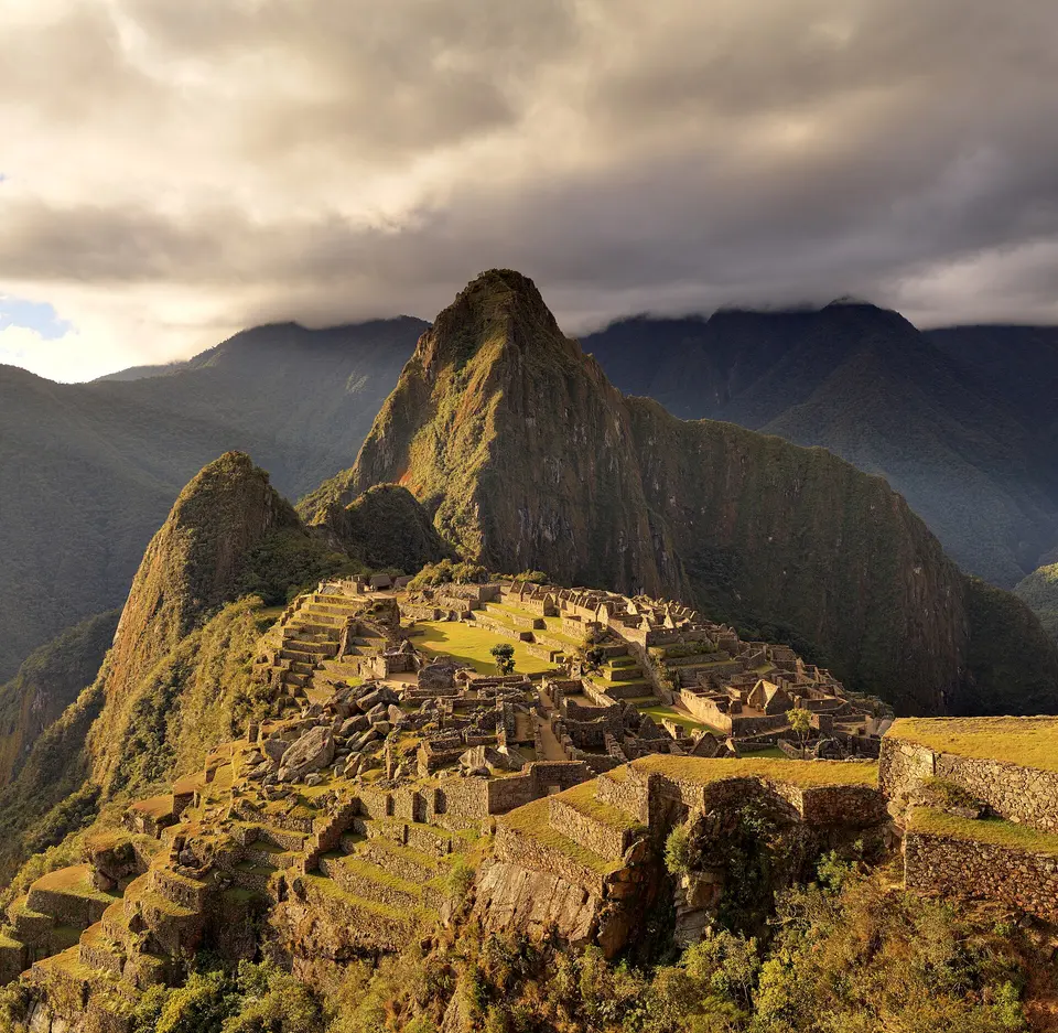
Machu Picchu
Photo: Martin St-Amant, CC BY-SA 3.0

Cusco on foot, then the Sacred Valley, then Machu Picchu

The order matters here. Cusco is at 3,400 metres, so day one is a gentle walk through the city while your body adjusts: the Plaza de Armas and the cathedral, the Inca sun temple that became the convent of Santo Domingo, lunch in the San Pedro market, the twelve-angled stone and the artisans' quarter of San Blas, and a taxi up to Sacsayhuamán for the sunset over the city. Day two descends into the Sacred Valley, 600 metres lower and easier to breathe in: the ruins and market of Pisac, the crop laboratory of Moray, the salt terraces of Maras and the fortress of Ollantaytambo, where you sleep. Day three is Machu Picchu by the first trains, back to Ollantaytambo or Cusco in the evening. Machu Picchu tickets are sold by circuit and entry hour and sell out weeks ahead in season; buy them first and build everything else around them.

At a glance

Ways to use these days

Lightest day on foot
Day 3 — 2.4 km between stops
Most walking
Day 2 — 57.7 km

Day 1

Cusco on foot: the plaza, the sun temple and Sacsayhuamán

Start slowly on the Plaza de Armas and in the cathedral, see the Inca walls of Qorikancha under the convent of Santo Domingo, eat in the San Pedro market, climb the lane of Hatun Rumiyoc past the twelve-angled stone to San Blas, and take a taxi up to the megalithic walls of Sacsayhuamán for the view at sunset.

  • 6 sights
  • 2.2 km on foot
  • Longest walk 870 m
123456500 mN
Stops in order, straight-line distancesRoute in Google Maps ↗

Morning

Plaza de Armas
Photo: Diego Delso, CC BY-SA 4.0
1Main square

Plaza de Armas

The Incas called it Huacaypata, the square of celebration, and it was twice its present size; the Spaniards ringed it with arcades and churches, the cathedral on the north side and the Jesuits' La Compañía, with its carved stone façade, on the east, and the arcaded colonial houses around the rest are now cafés with balconies over the square. Start here, slowly, with the fountain and the flags in the middle and the hills closing in on every side.
  • Plan about 45 min
90 m · about 1 min on foot
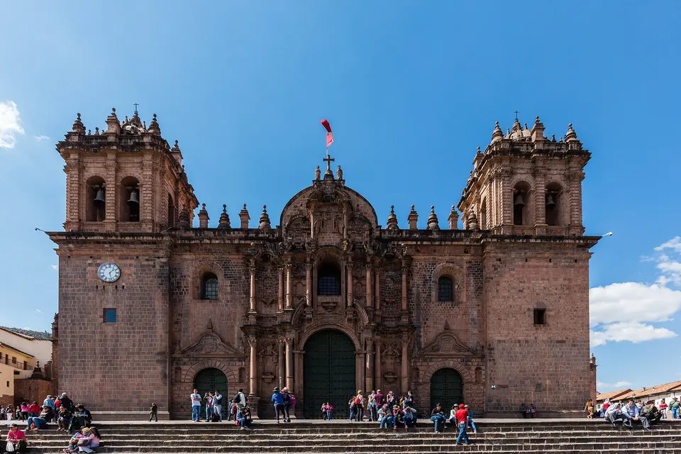
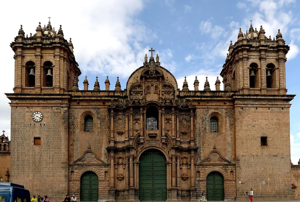
Cusco Cathedral
Photo: Martin St-Amant, CC BY 3.0
2Cathedral

Cusco Cathedral

Built between 1560 and 1654 on the palace of the Inca Viracocha with stones carried down from Sacsayhuamán, the cathedral is the treasure house of the Cusco school of painting: hundreds of canvases, among them the Last Supper in which the disciples eat guinea pig, a silver high altar, a cedar choir and the earthquake Christ, the blackened crucifix carried through the streets every Easter Monday. The tourist entrance is on the side, through the church of the Sagrada Familia.

  • Plan about 1 h
  • Tourist ticket at the door, separate from the city tourist ticket; free at Mass times
500 m · about 8 min on foot
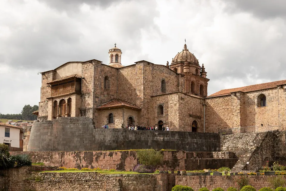
Qorikancha and the Convent of Santo Domingo
Photo: Brian Jeffery Beggerly, CC BY 2.0
3Inca temple and convent

Qorikancha and the Convent of Santo Domingo

The Temple of the Sun was the holiest building of the Inca empire, its walls lined with sheets of gold and its garden planted with golden maize; the Spaniards stripped it and built the Dominican convent on top, and the 1950 earthquake that cracked the church left the Inca walls beneath it standing without a crack. Inside, the curved outer wall, the perfectly fitted chambers of the sun, moon and stars and the trapezoid niches show what Inca masonry could do; the convent's cloister and paintings are on the same ticket.

  • Plan about 1 h 15 min
  • Ticket at the door, separate from the city tourist ticket

Midday

750 m · about 12 min on foot
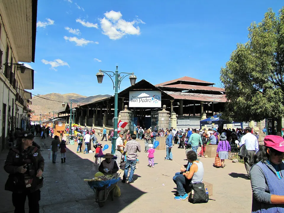
San Pedro Market
Photo: Chuck Moravec, CC BY 2.0
4Covered market

San Pedro Market

The city's central market, in an iron hall designed by Gustave Eiffel's company, is the place for lunch on the first day: rows of juice stalls that blend whatever fruit you point at, soup counters serving caldo de gallina, cheese, bread, chocolate and coca leaves, and the aisles of alpaca sweaters and blankets at the back that are cheaper than the shops. Go before 14:00, when the food stalls are busiest and freshest.

  • Plan about 1 h

Afternoon

870 m · about 14 min on foot
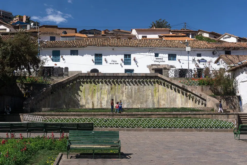
Hatun Rumiyoc and San Blas
Photo: Alexey Komarov, CC BY-SA 4.0
5Inca street and artisans' quarter

Hatun Rumiyoc and San Blas

The lane of Hatun Rumiyoc climbs from the cathedral between Inca walls, and halfway up is the twelve-angled stone, the most photographed block of masonry in Peru, fitted into the wall of the palace of Inca Roca without mortar so tightly that a blade will not enter. The lane continues up to San Blas, the artisans' quarter of white houses and blue balconies on the steep slope, with its small church, whose carved cedar pulpit is the finest in the Americas, the workshops of the Mendívil and Olave families and cafés with views over the roofs.

  • Plan about 1 h 30 min

Evening

Taxi from San Blas, about 10 minutes; on foot it is a steep 30-minute climb up Calle Suecia and the Resbalosa steps, better saved for a later day
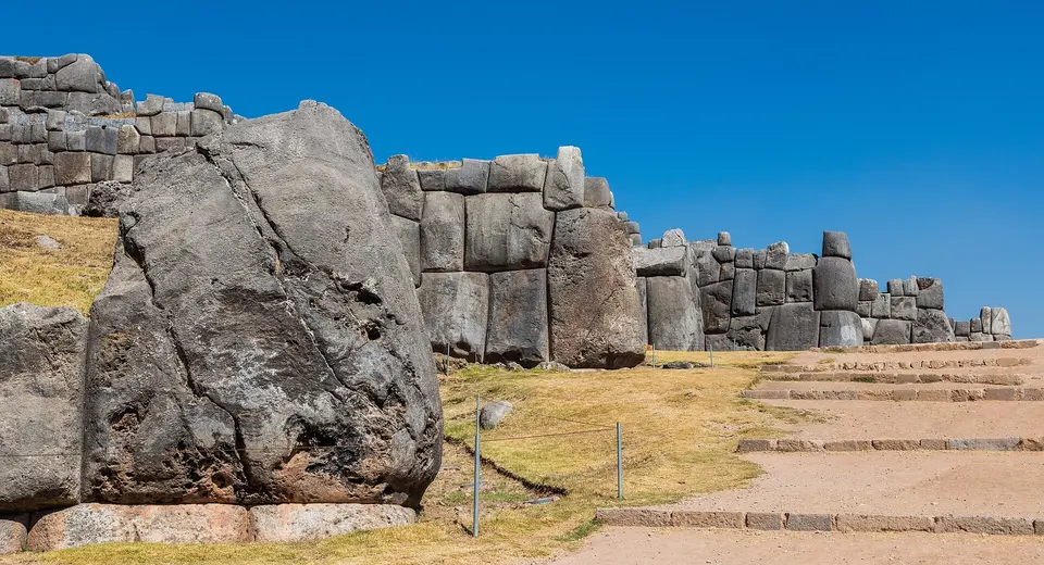
Sacsayhuamán
Photo: Diego Delso, CC BY-SA 4.0
6Inca fortress

Sacsayhuamán

On the hill above the city, three tiers of zigzag walls 400 metres long are built of limestone blocks up to nine metres high and 120 tonnes, fitted with the same precision as the twelve-angled stone; the Incas used it as a temple and fortress, and Manco Inca's army held it against the Spaniards in the siege of 1536. Come at 16:00, walk the walls and the grassy plaza where the Inti Raymi festival is staged each June, and watch the sun go down over the red roofs of Cusco; the white Christ on the next hill is a ten-minute walk.

  • Plan about 1 h 30 min
  • On the Cusco tourist ticket; open until 18:00; bring a jacket for the sunset

Day 2

The Sacred Valley: Pisac, Moray, Maras and Ollantaytambo

Drive over the pass to the terraces and market of Pisac, follow the Urubamba river to lunch, climb to the circular terraces of Moray and the salt pans of Maras, and end at the fortress of Ollantaytambo, where you stay the night for the early train.

  • 4 sights
  • Transport between sights
12345 kmN
Stops in order, straight-line distancesDriving route in Google Maps ↗

Morning

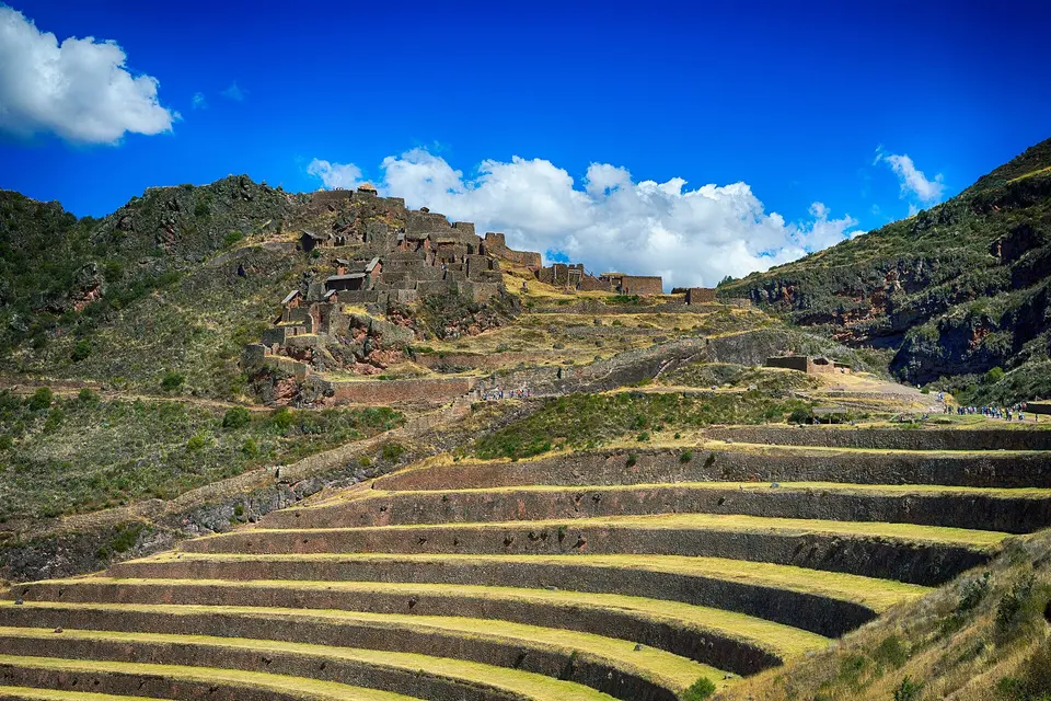
Pisac
Photo: Tydence Davis, CC BY 2.0
1Inca ruins and market

Pisac

The Inca town of Pisac climbs a spur above the Sacred Valley in sweeping terraces to a ridge of temples, baths and a sun temple around a carved rock, with the largest Inca cemetery known honeycombing the cliff opposite; a car takes you to the top gate, and the walk down the terraces to the village takes an hour and a half. The village below, with its colonial church and Inca-walled streets, holds the valley's best-known craft market, biggest on Sundays, when the villagers come down in traditional dress for Mass.

  • Plan about 2 h 30 min
  • On the Cusco tourist ticket; the ruins open from 7:00, the market is at its biggest on Sundays

Midday

LunchUrubamba, halfway along the valley, is where the day-tour buses stop: family restaurants with buffets of Andean dishes, and the quieter hacienda restaurants on the edge of town serving trout, cuy and quinoa soups.

Afternoon

About 90 minutes by car via Urubamba; lunch in Urubamba on the way
Moray
Photo: F Delventhal, CC BY 2.0
2Inca agricultural terraces

Moray

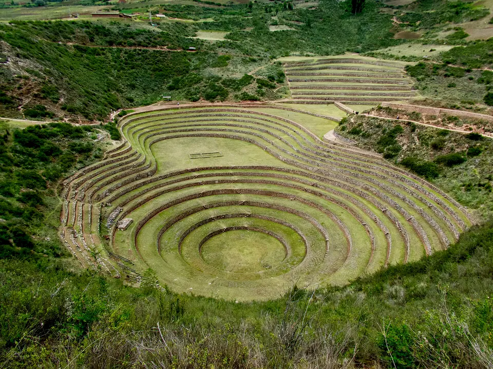
Three sets of circular terraces sunk like amphitheatres into natural hollows in the high plateau, the largest 30 metres deep, are thought to have been an Inca agricultural laboratory: the temperature between the top and bottom rings differs by several degrees, and the terraces may have been used to test crops for different altitudes. Walk the rim of the big one for the shape, and down into it for the silence.

  • Plan about 1 h
  • On the Cusco tourist ticket
About 15 minutes by car down the dirt road from Moray
Maras salt pans
Photo: Diego Delso, CC BY-SA 4.0
3Salt terraces

Maras salt pans

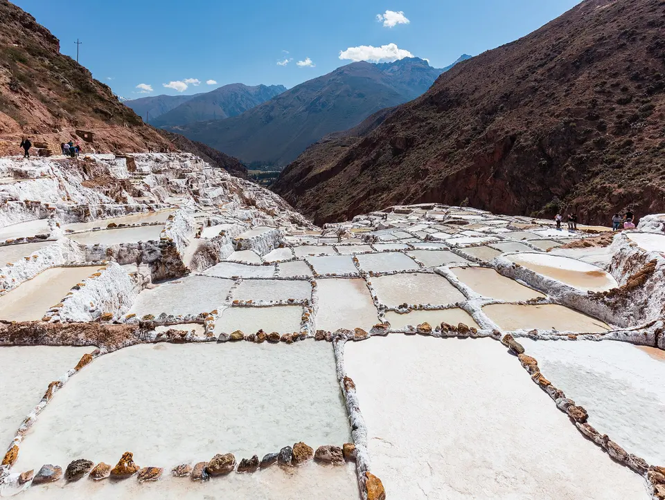
A salt spring on the hillside below the village of Maras has been channelled since before the Incas into some 3,000 shallow pans that step down the ravine like a white and brown mosaic; the families of Maras still own them, and in the dry season you can see the water evaporating and the salt being scraped and carried up in sacks. The viewpoints are on the road above; walking on the pans is no longer allowed.

  • Plan about 1 h
  • Ticket at the entrance, run by the Maras community, not on the tourist ticket

Evening

About 40 minutes by car down the valley
Ollantaytambo
Photo: Steve FUNG, CC BY-SA 4.0
4Inca fortress and town

Ollantaytambo

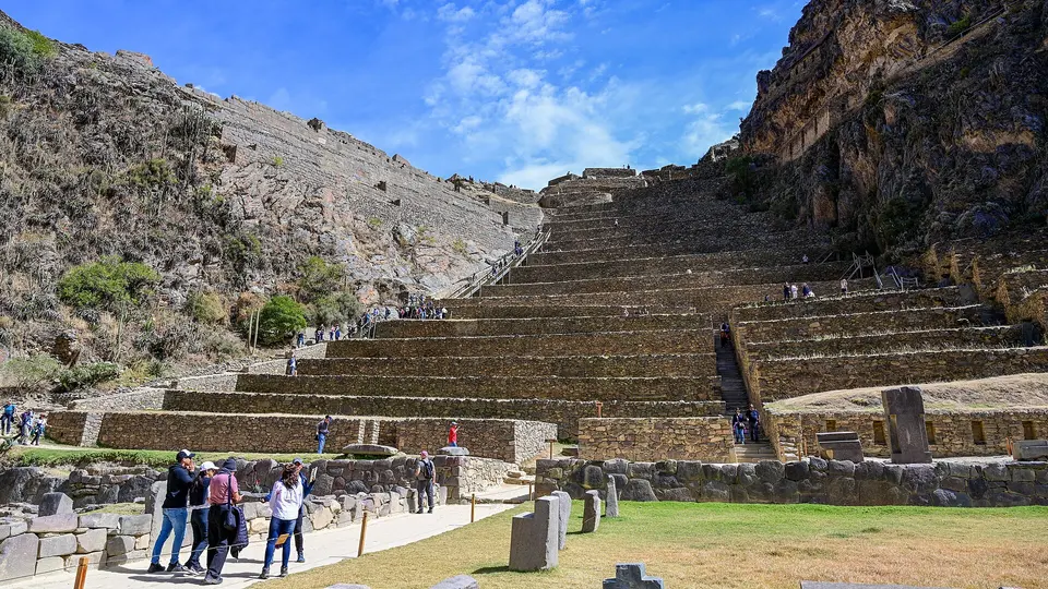
The only Inca town still lived in, with its 15th-century grid of streets, water channels and courtyard houses intact, sits below the terraces of the Temple Hill, the fortress where Manco Inca defeated Pizarro's brother in 1537: seventeen terraces climb to the unfinished Sun Temple, six enormous pink granite monoliths dragged from a quarry across the valley. Climb it in the late afternoon light, walk the old streets, and stay the night; the Machu Picchu trains leave from the station at the bottom of town.

  • Plan about 2 h
  • On the Cusco tourist ticket; open until about 17:00

Day 3

Machu Picchu

Take one of the first trains down the valley to Machu Picchu Pueblo, the bus up the switchbacks, and your timed circuit through the citadel while the cloud lifts; come down for lunch in the town and take the afternoon train back to Ollantaytambo or Cusco.

  • 2 sights
  • Transport between sights
12500 mN
Stops in order, straight-line distancesRoute in Google Maps ↗

Morning

Machu Picchu
Photo: Martin St-Amant, CC BY-SA 3.0
1Inca citadel

Machu Picchu

The estate of the emperor Pachacuti, built around 1450 on a ridge 2,430 metres up between the peaks of Machu Picchu and Huayna Picchu and abandoned a century later, was never found by the Spaniards; Hiram Bingham reached it in 1911 and it has been the most famous sight in South America since. Visits follow numbered circuits with a timed entry: the upper terraces for the classic view, the Temple of the Sun, the Intihuatana stone, the Sacred Plaza and the lower residential quarter. Go in with the first entry, before the cloud lifts off the peaks and before the day-trippers arrive from the late trains.

  • Plan about 4 h
  • Timed ticket by circuit from tuboleto.cultura.pe; foreign adults S/152 plus an S/11 conservation fee; entry from 6:00; passport required

Midday

LunchEat in Machu Picchu Pueblo after the visit: the restaurants along the railway line and the river are tourist-priced but fine, and the market by the station is the cheap alternative; there is a café at the citadel gate for a snack before you go in.

Afternoon

Bus down from the citadel gate, about 20 minutes
Machu Picchu Pueblo (Aguas Calientes)
Photo: Diego Delso, CC BY-SA 4.0
2Town

Machu Picchu Pueblo (Aguas Calientes)

The town that exists only to serve the citadel is squeezed into the gorge of the Urubamba at the foot of the mountain: a railway line running down the main street, a market, hotels stacked up the slopes, the hot springs that gave it its old name a ten-minute walk up the valley, and the bus queue for the ruins. It is not beautiful but it is the place for lunch and a soak before the train back.

  • Plan about 1 h 30 min
  • Consettur buses up from 5:30, last uphill bus 16:00; $23 one way, $35 return

Evening

DinnerThe afternoon trains run to Ollantaytambo, with buses on to Cusco, and a few through to Poroy near the city; dinner is back in Cusco, on the Plaza de Armas or in the restaurants of San Blas.

Good to know in Cusco

Machu Picchu tickets and transport

  • Machu Picchu is visited on three circuits with different routes, with entry from 6:00 a.m.; tickets are sold on the Ministry of Culture's platform tuboleto.cultura.pe and in person at the Centro Cultural de Machupicchu Pueblo, which offers 1,000 tickets a day. Foreign adults pay S/152, foreign students S/77 and foreign minors aged 3–17 S/70; entry tolerance is 45 minutes in high season.Source: Dirección Desconcentrada de Cultura de Cusco, Ministry of Culture · checked Sep 2026
  • From May 1, 2026 foreign visitors to Machu Picchu pay an additional S/11 (nationals S/5) as a conservation fee on top of the S/152 entry, about S/163 in all; the 2026 package also brought advance sales on a renewed ticket platform and a new carrying-capacity study.Source: Infobae Perú · checked Sep 2026
  • The maximum daily capacity of Machu Picchu for 2026 is 5,600 visitors in high season, which applies on January 1, April 2–5, June 19 to November 2 and December 30–31; routes with mountain climbs (Machu Picchu Mountain, Huayna Picchu, the Gran Caverna) are priced separately.Source: Infobae Perú · checked Sep 2026
  • Consettur buses between Machu Picchu Pueblo and the citadel cost $23 one way and $35 return for foreign adults; the first bus goes up at 5:30 a.m. and the last at 4:00 p.m., with return buses from 7:30 a.m. until everyone is down. The ride up takes about 25 minutes.Source: Consettur · checked Sep 2026
  • PeruRail's first trains from Ollantaytambo to Machu Picchu Pueblo leave at 5:05 and 6:10 (Expedition), with services through the day; the journey takes about 1 hour 30 minutes. Return trains run from 5:35 in the morning to 21:50, most of them in the afternoon between 13:37 and 18:20.Source: PeruRail · checked Sep 2026

3 days in Cusco: quick answers

Is 3 days enough for Cusco and Machu Picchu?

Three days give one day in the city, one across the Sacred Valley and one at Machu Picchu, which is the minimum that works. A fourth day allows a second morning at Machu Picchu with the Huayna Picchu or Machu Picchu Mountain climb, Chinchero's weavers and Tipón's Inca waterworks, or the long day trip to the Rainbow Mountain.

How do I get Machu Picchu tickets?

Tickets are sold by circuit and by entry hour on the Ministry of Culture's official site, tuboleto.cultura.pe, and at the ticket office in Machu Picchu Pueblo, which keeps 1,000 tickets a day for sale in person. The 2026 price for foreign adults is S/152 for the standard circuits, plus a conservation fee of S/11 since May; capacity is 5,600 a day in high season and less the rest of the year. In high season buy weeks ahead; circuit 2 is the classic first-time route.

What about altitude?

Cusco is at 3,400 metres, higher than Machu Picchu (2,430) and the Sacred Valley (2,800). Day one is deliberately light: walk slowly, drink water and coca tea, eat lightly and skip alcohol. If you arrive by air, spending the first night in the Sacred Valley instead of the city is the gentler option.

Which days should I plan around?

Machu Picchu and the Sacred Valley sites are open every day. Pisac's big market is on Sundays, with smaller ones on Tuesdays and Thursdays. The Sacred Valley sites are on the Cusco tourist ticket, sold at the COSITUC office on Avenida El Sol and at the sites; the cathedral and Qorikancha are ticketed separately at their doors.

How much walking is this itinerary?

About 2 km in a straight line on day one, all of it uphill from the plaza to San Blas; day two is short walks at each site with the car in between, the Pisac and Ollantaytambo ruins on steep terraces; day three is two to three hours on the stone stairways of Machu Picchu, with the bus doing the climb.

Other Cusco itineraries

Keep exploring

Where this connects

THE TRIPWOA APP

Go somewhere.
Make it yours.

Build days around what you love. Follow your route, find your next stop and keep the moments along the way.

Get it on Google PlayAvailable for Android
Free to start
Tripwoa home with a Paris trip and nearby places to explore
Tripwoa day plan for New York with a route map and Times Square stop

A day that feels like you.

Sources and method

Places and coordinates: Wikidata and Tripwoa's open-data place catalog (Overture Maps Foundation, © OpenStreetMap contributors). Photos: Wikimedia Commons, credited on each image. Practical rules: the official sources linked in each note, checked in September 2026.

How this plan was made: Tripwoa's planner drafted the day order from real coordinates and typical visit times. Each stop was then reviewed, reordered where needed and rewritten with AI assistance. Walking distances are straight-line estimates, so allow a little extra time on real streets.