1Market
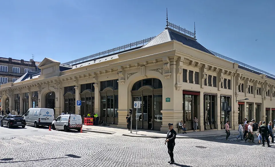
Mercado do Bolhão
Produce and food stalls fill the restored market building in the upper centre. Browse before the day becomes busy and leave time for breakfast or a coffee rather than rushing from counter to counter.

3-day itinerary · Portugal
Three days from Porto’s market and tiled streets to the Douro, then west to Serralves and the Atlantic. The historic centre is grouped for walking, with one clear transport leg and enough time to take the hills at a comfortable pace.
Updated 11 September 2026 · 5 official sources checked · report an error
The plan at a glance
Start in the upper centre before descending to the river on the second day. The bridge visit ends on the Gaia side, so allow for a climb to Jardim do Morro. The final day gives Serralves a substantial museum-and-park visit before a coastal walk at Foz. This is a city itinerary; a Douro Valley excursion needs another day.
At a glance
Day 1
Begin at Bolhão and the Chapel of Souls, then walk through Aliados to São Bento. After lunch, visit Lello at your booked time, look at Carmo’s exterior and finish with Clérigos.
Morning
Produce and food stalls fill the restored market building in the upper centre. Browse before the day becomes busy and leave time for breakfast or a coffee rather than rushing from counter to counter.
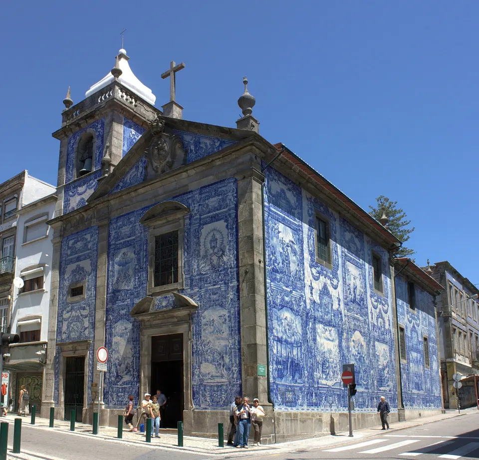
Blue-and-white tile panels wrap around the chapel’s exterior beside a busy shopping street. This is mainly an outdoor pause; enter only when visiting access fits around worship.
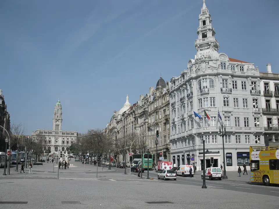
Grand civic and commercial façades frame the sloping avenue toward the city hall. Walk down toward Praça da Liberdade as part of the route to São Bento.
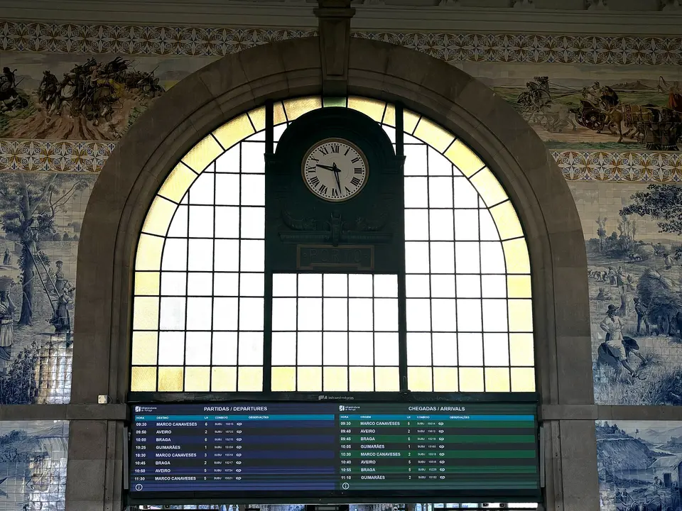
Tile panels in the entrance hall turn a working station into a lesson in Portuguese history and transport. Pause to look at the walls while leaving the routes to platforms clear for passengers.
Midday
Afternoon
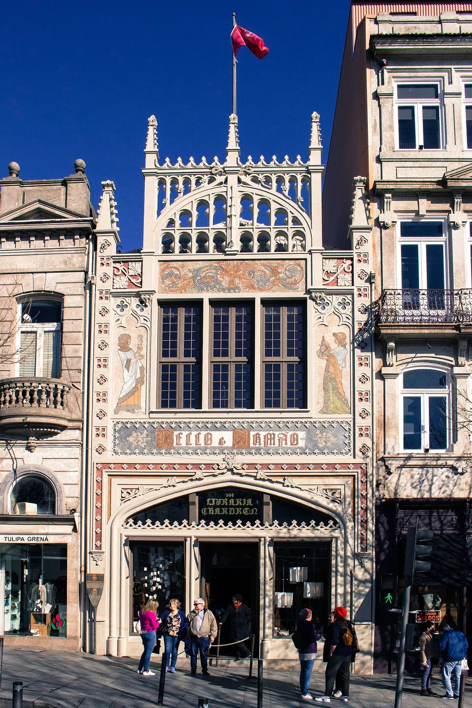
Carved wood, stained glass and a winding staircase make the bookshop an architectural attraction as well as a place to browse. Use a booked entry window and expect a shared, busy interior.
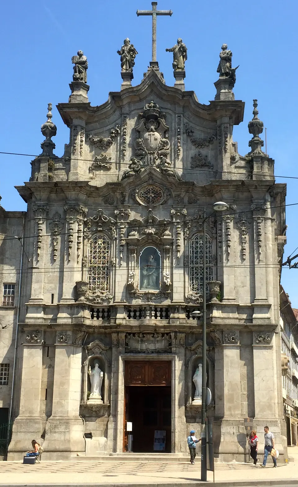
The church’s tiled side wall is one of the distinctive façades around Praça de Gomes Teixeira. This itinerary plans an exterior stop; entering the religious complex would take additional time.
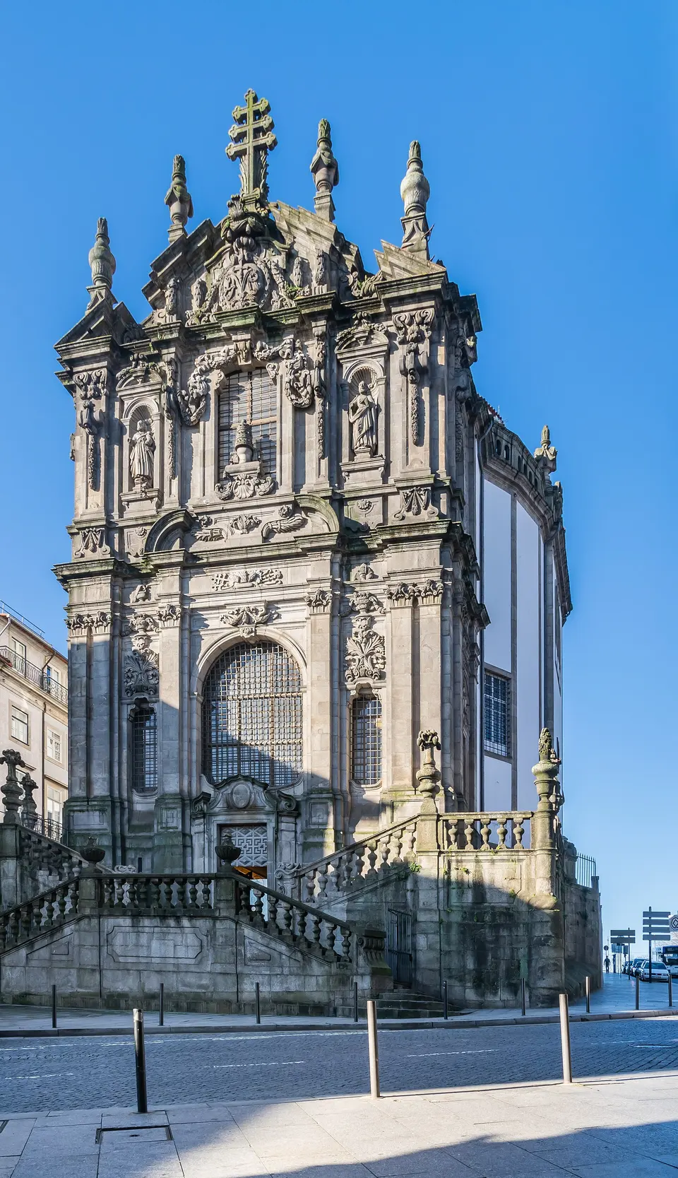
The tower rises above the old centre and makes the city’s hills and river setting easier to understand. Choose the church and tower visit according to your energy; the viewpoint involves stairs.
Evening
Day 2
Start at the cathedral, descend to Palácio da Bolsa and take its guided tour. After lunch, visit São Francisco, explore Ribeira and cross the bridge’s lower deck before the climb to Jardim do Morro.
Morning
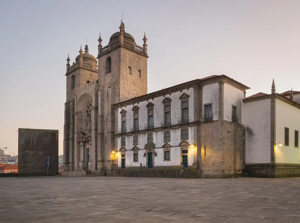
The cathedral occupies high ground above the river, with a terrace that explains the city’s steep layout. Allow time for the church and whichever adjoining areas your ticket includes before descending into the old streets.

The former stock exchange expresses Porto’s commercial ambitions through richly decorated reception rooms. The visit is guided, so the time allowance includes checking the next suitable tour and a buffer around its departure.
Midday
Afternoon
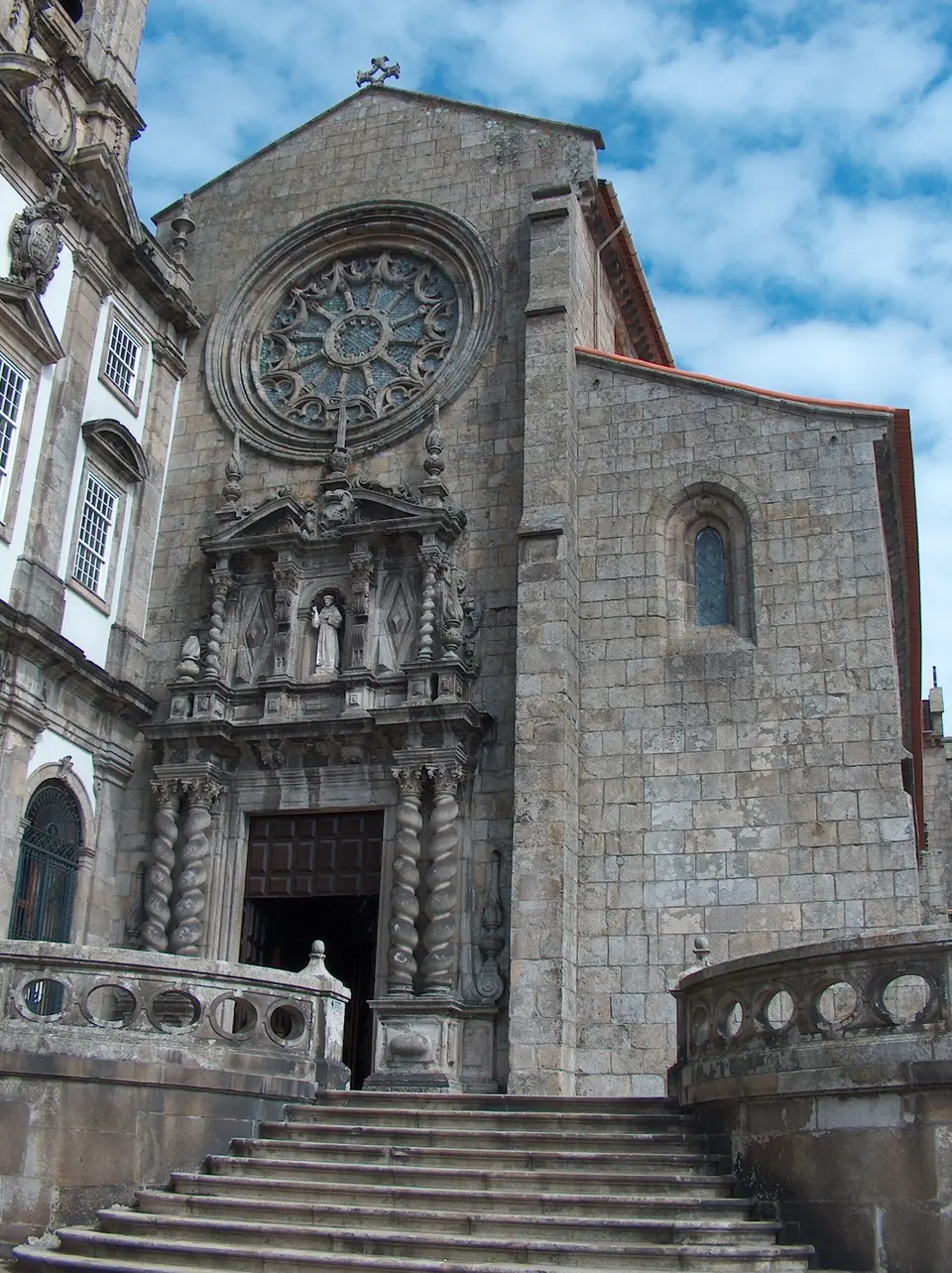
A Gothic exterior gives way to an interior known for its elaborate gilded decoration. Make this a focused visit after the palace, with a rest before the riverfront walk.
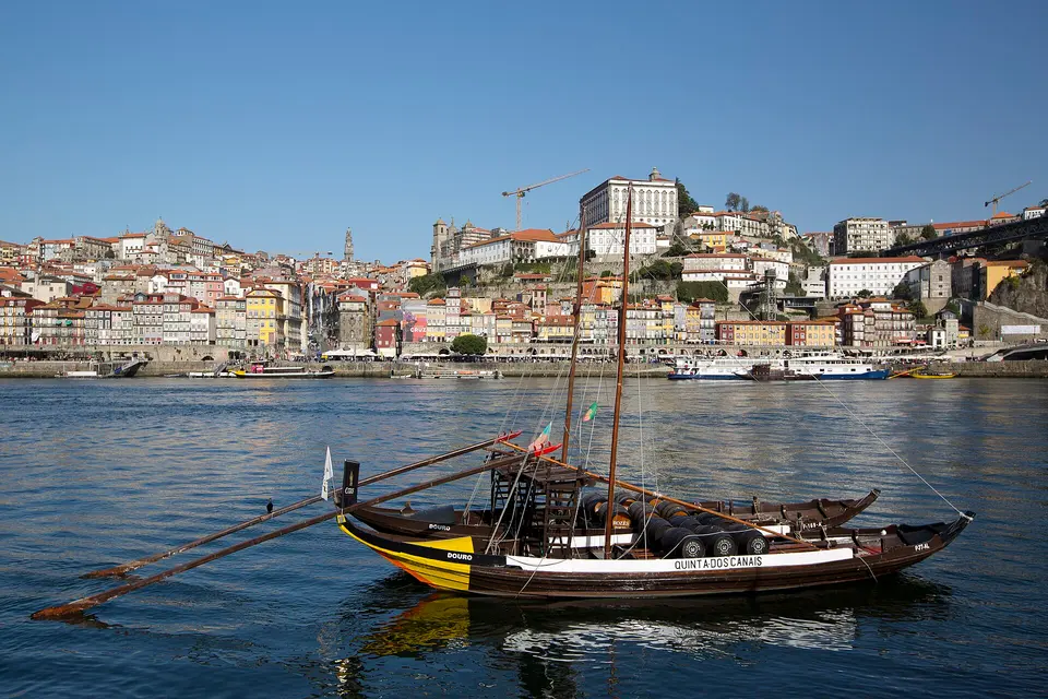
Narrow lanes emerge onto the quay beside the Douro, where the bridge and Gaia’s riverbank fill the view. Walk a short section of the waterfront and allow time to sit rather than treating the district as one photo pin.
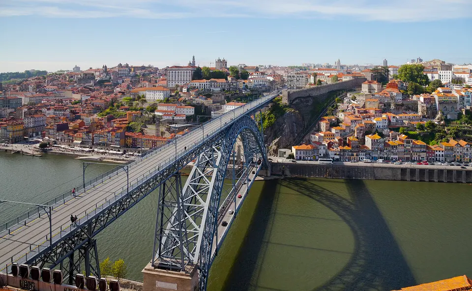
Two decks connect Porto and Vila Nova de Gaia at different heights above the Douro. This route crosses the lower deck from Ribeira before climbing on the Gaia side; check that your walking directions use the intended level.
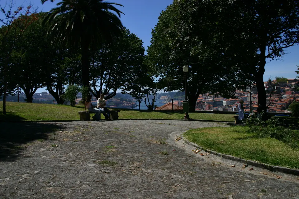
The hillside garden looks across the Douro toward Porto’s old centre. The ascent from the lower riverbank is part of reaching the viewpoint, so arrive with enough time to rest before enjoying the view.
Evening
Day 3
Travel to Serralves for a substantial visit to the museum and park. After lunch, use local transport to Foz and spend the afternoon along the river mouth and ocean promenade.
Morning
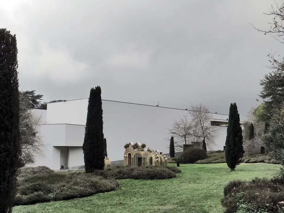
Contemporary art galleries open into a large landscape of gardens, trees and outdoor works. Choose a museum route and a park circuit within this combined visit; the wider estate can easily fill more time.
Midday
Afternoon
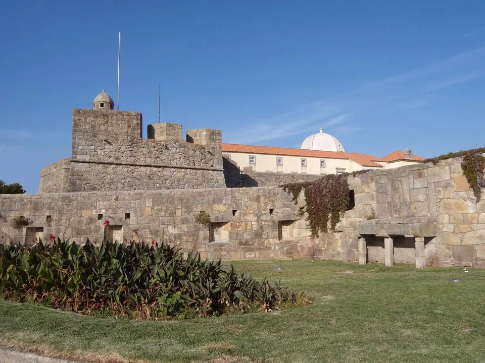
Where the Douro reaches the Atlantic, riverside gardens give way to an ocean promenade and small beaches. Start around the fort and Passeio Alegre, then choose a comfortable coastal walk without trying to cover the entire seafront.
Evening
Before you go
Questions
Three full days cover the historic centre, the river and Gaia viewpoints, plus Serralves and Foz. A vineyard excursion in the Douro Valley is a separate day.
No cellar or tasting is assumed. If that is a priority, replace part of the second afternoon with a booked Gaia cellar visit and keep the viewpoint optional.
The lower deck after Ribeira. Jardim do Morro is much higher, so the next leg includes an uphill approach on the Gaia side. Do not follow an upper-deck map pin as if it were at river level.
These are farther west and deserve a separate day. Use transport to Serralves, between the estate and Foz as needed, and for the return journey; those journeys are additional to the central walking days.
Bolhão, Aliados and the streets near São Bento offer convenient bases for the first two days. Ribeira has an atmospheric river setting, but consider the steep walk back uphill when choosing accommodation.
More time or less
Keep exploring
THE TRIPWOA APP
Build days around what you love. Follow your route, find your next stop and keep the moments along the way.
 Available for Android
A day that feels like you.
Places and coordinates: Wikidata and Tripwoa's open-data place catalog (Overture Maps Foundation, © OpenStreetMap contributors). Photos: Wikimedia Commons, credited on each image. Practical rules: the official sources linked in each note, checked in September 2026.
How this plan was made: Tripwoa's planner drafted the day order from real coordinates and typical visit times. Each stop was then reviewed, reordered where needed and rewritten with AI assistance. Walking distances are straight-line estimates, so allow a little extra time on real streets.