3-day itinerary · Japan

3 Days in Hiroshima

A realistic first-timer plan that walks the city on day one, from the Atomic Bomb Dome and the Orizuru Tower through the Peace Memorial Park and Museum to the castle grounds, the garden of Shukkei-en and the Hondori arcade for dinner; takes the train and ferry to Miyajima on day two for the Itsukushima Shrine at high tide, the temple of Daisho-in, the ropeway up Mount Misen and the lit torii at dusk; and spends day three at the waterfall temple of Mitaki-dera and across the prefectural border at Iwakuni, for the five arches of the Kintai Bridge and the castle above it. Every stop comes with walking distances and the hours, fares and closures that apply in 2026.

  • 3days
  • 15sights
  • 7.0 kmon foot between sights

Updated 12 September 2026 · 10 official sources checked · report an error

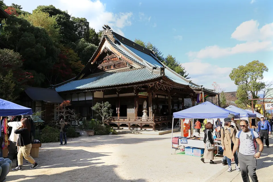
Itsukushima Shrine
Photo: shankar s., CC BY 2.0

The Peace Park and the city, then Miyajima, then Mitaki-dera and Iwakuni

Hiroshima's centre is flat and small, so day one is a single walk: the Atomic Bomb Dome at 8:30 before the school groups, the folded-crane wall of the Orizuru Tower next to it, the Peace Memorial Park and the museum, okonomiyaki for lunch, the castle grounds (the keep itself closed in March 2026), the garden of Shukkei-en and the Hondori arcade in the evening. Day two is Miyajima, timed to the tide: the shrine when the water is under it, Daisho-in's stairways, the ropeway and the summit of Misen, and the torii lit after dark. Day three goes out of town twice, to the three waterfalls and mossy statues of Mitaki-dera in the morning and by train to Iwakuni for the Kintai Bridge and the castle ropeway, back for oysters and bars in Nagarekawa. Check the Miyajima tide table before you fix the days.

At a glance

Ways to use these days

Lightest day on foot
Day 2 — 3.3 km between stops
Most walking
Day 3 — 73.5 km

Day 1

The Peace Park, the castle and Shukkei-en

Stand under the Atomic Bomb Dome early, go up the Orizuru Tower for the view over it, walk the Peace Memorial Park to the cenotaph and through the museum, eat okonomiyaki, then walk north to the castle moat and the Ninomaru, east to the garden of Shukkei-en, and back down to the Hondori arcade for the evening.

  • 7 sights
  • 4.1 km on foot
  • Longest walk 1.4 km
1234567500 mN
Stops in order, straight-line distancesRoute in Google Maps ↗

Morning

Atomic Bomb Dome
Photo: Oilstreet, CC BY 2.5
1Memorial

Atomic Bomb Dome

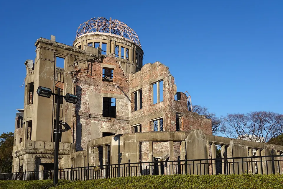
The Industrial Promotion Hall of 1915, a brick building with a copper dome by the Czech architect Jan Letzel, stood 160 metres from the point above which the bomb exploded at 8:15 on 6 August 1945; the blast came almost straight down, and the skeleton of the dome and the walls survived when everything around was flattened. Left as it was, it became the Peace Memorial and a World Heritage Site in 1996. Come at 8:30, when the river is quiet, and walk round it before crossing the bridge into the park.
  • Plan about 30 min
100 m · about 2 min on foot
Orizuru Tower
Photo: Taisyo, CC BY 3.0
2Observation deck

Orizuru Tower

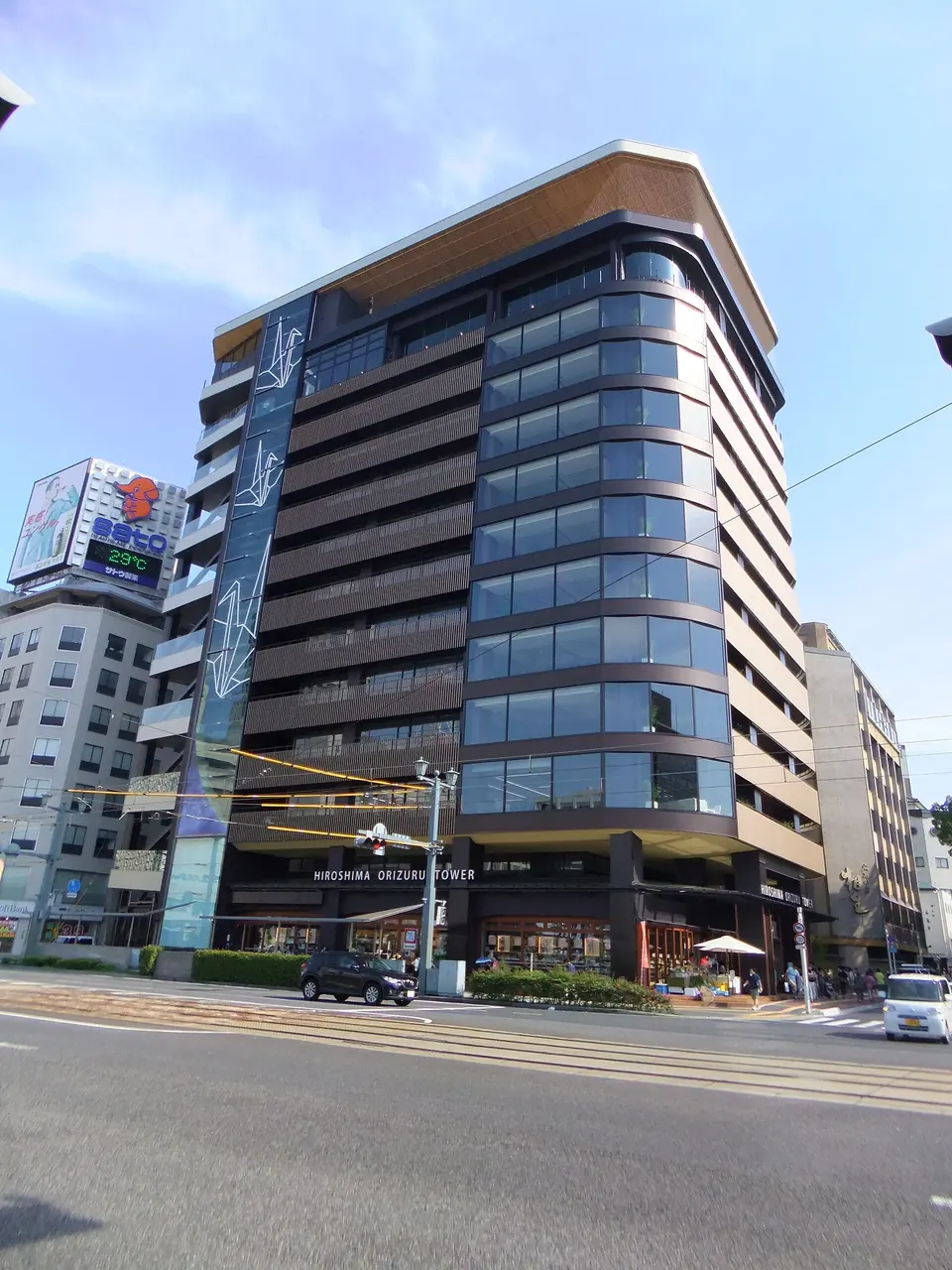
Next to the dome, the rooftop deck of this 2016 tower, an open wooden terrace under a roof, looks straight down on the dome and the whole Peace Park, out to Miyajima on a clear day; on the floor below, the Orizuru Wall, you fold a paper crane and drop it into the glass wall with the hundreds of thousands folded before. A spiral slide takes you back down. It is expensive for what it is, but the view over the dome is the one you will keep.

  • Plan about 1 h
  • 10:00–18:00, admission until 17:30; ¥2,200, crane folding ¥100
390 m · about 6 min on foot
Peace Memorial Park
Photo: shankar s., CC BY 2.0
3Memorial park

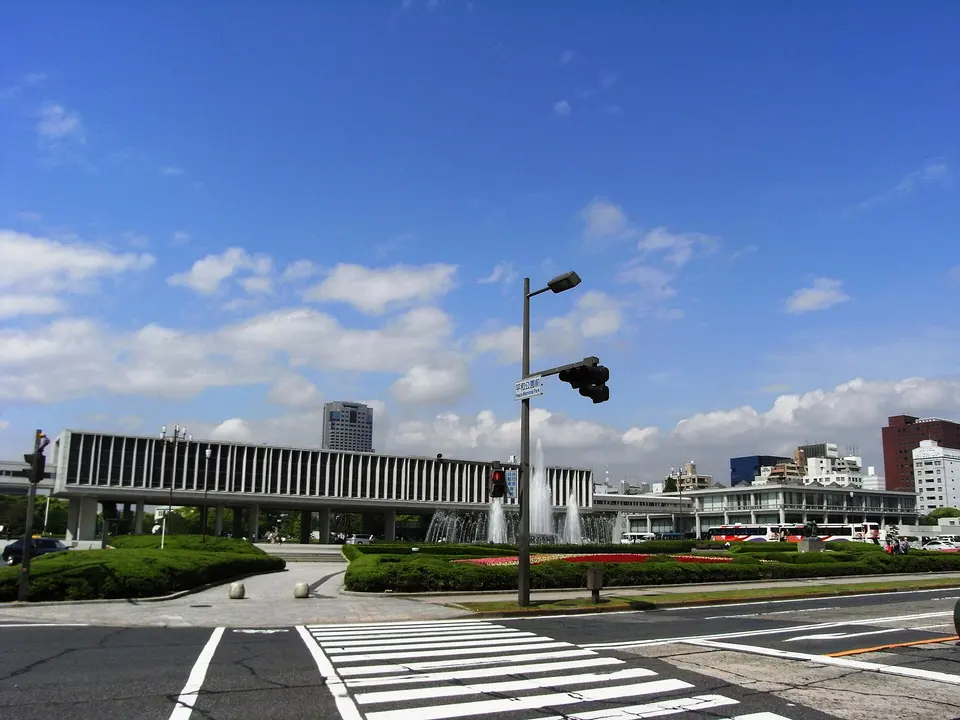
Peace Memorial Park

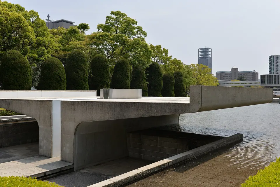
Kenzo Tange laid out the park in 1954 on the flattened delta between the rivers so that the arch of the Memorial Cenotaph, the Flame of Peace, which will burn until the last nuclear weapon is gone, and the dome across the water line up on one axis; the Children's Peace Monument, with the statue of Sadako Sasaki holding a crane and the glass cases of paper cranes sent from all over the world, the Peace Bell and the mound of unclaimed ashes are on the paths around it. Walk it slowly, from the dome to the museum.

  • Plan about 1 h
150 m · about 2 min on foot
Peace Memorial Museum
Photo: Taisyo, CC BY-SA 3.0
4Museum

Peace Memorial Museum

The museum at the south end of the park tells what happened to the city and its people on 6 August 1945 through what was left: a tricycle, a watch stopped at 8:15, a lunch box, the shadow of a man on stone steps, the clothes of schoolchildren, and the photographs and drawings of the survivors, alongside the history of the bomb and the case against nuclear weapons. It is harrowing, essential and very crowded from mid-morning; go in when it opens or after 15:00, and allow two hours.

  • Plan about 2 h
  • ¥200; 7:30–19:00 (Mar–Jul, Sep–Nov), to 20:00 in August, to 18:00 Dec–Feb; closed Dec 30–31

Midday

LunchOkonomimura, three floors of okonomiyaki counters in a building off Chuo-dori, is where to eat Hiroshima's version, layered with noodles and cooked in front of you; the queues at the famous stalls move fast, and any counter with locals at it is good.

Afternoon

1.4 km · about 21 min on foot
Hiroshima Castle
Photo: そらみみ, CC BY-SA 4.0
5Castle grounds

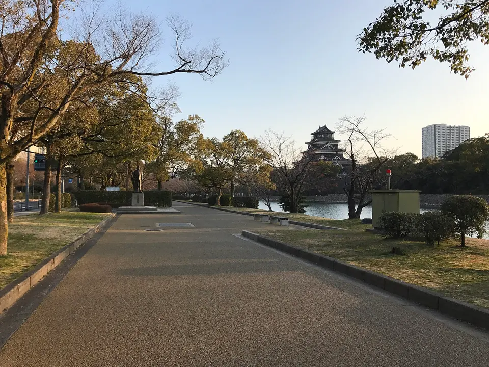
Hiroshima Castle

Mori Terumoto built the 'carp castle' on the delta in 1589, and it stood until the bomb; the five-storey keep was rebuilt in concrete in 1958 and closed to visitors in March 2026 because it no longer meets earthquake standards. The grounds inside the moat are still the walk: the restored wooden gate and yagura towers of the Ninomaru, free to enter, the bomb-scarred stone walls, the eucalyptus that survived 1945 and the Gokoku Shrine, with the keep to photograph from across the water.

  • Plan about 1 h
  • Keep closed since March 2026; Ninomaru buildings free, 9:00–17:30 Apr–Sep, 9:00–16:30 Oct–Mar
820 m · about 13 min on foot
Shukkei-en
Photo: Jakub Hałun, CC BY-SA 4.0
6Japanese garden

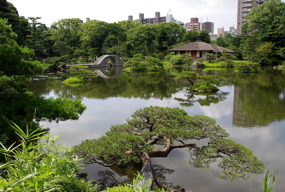
Shukkei-en

The 'shrunken scenery garden' was laid out in 1620 by the tea master Ueda Soko for the lord of the castle as a walk around a pond of islands, arched bridges, tea houses and miniature mountains and valleys, modelled on the West Lake at Hangzhou; destroyed in 1945, it was replanted and reopened in 1951, and the rainbow bridge of Kokokyo and the carp and turtles in the pond are its centre. It is the calm half-hour of the day, five minutes from the castle.

  • Plan about 1 h
  • 9:00–18:00 (Mar 16–Sep 15), 9:00–17:00 otherwise, last entry 30 minutes before; ¥350; closed Dec 29–31

Evening

1.2 km · about 19 min on foot
Hondori
Photo: Christophe95, CC BY-SA 4.0
7Shopping arcade

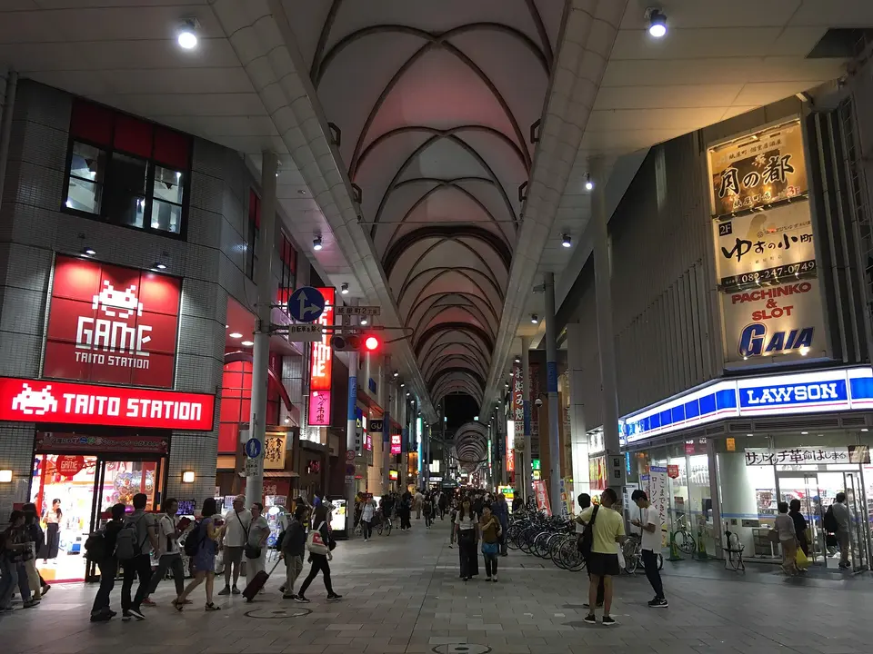
Hondori

The covered arcade of Hondori runs 577 metres from the edge of the Peace Park through the centre of the city, the shopping street since the Edo period and rebuilt after the war: department stores, sweet shops, game centres, restaurants and the side streets to Okonomimura and the Parco. It is where the city walks in the evening and the way to dinner; the bars of Nagarekawa are three blocks further east.

  • Plan about 1 h 30 min

Day 2

Miyajima: the floating shrine, Daisho-in and Mount Misen

Take the train and ferry to Miyajima, walk through Itsukushima Shrine while the tide is under it, climb the stairways of Daisho-in, ride the ropeway up Mount Misen and walk to the summit, come down past the pagoda of Senjokaku, and stay for the torii lit at dusk.

  • 4 sights
  • 2.1 km on foot
  • Longest walk 1.6 km
1234500 mN
Stops in order, straight-line distancesRoute in Google Maps ↗

Morning

Itsukushima Shrine
Photo: shankar s., CC BY 2.0
1Shinto shrine

Itsukushima Shrine

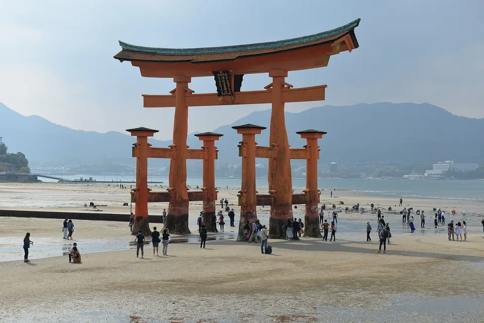
The shrine has stood over the water of the bay since the 6th century and in its present form since Taira no Kiyomori rebuilt it in 1168: vermilion halls and 300 metres of covered corridors on piles, so that at high tide the whole complex floats, with the 16-metre camphor-wood torii, restored in 2022, standing in the sea in front. It is a World Heritage Site and the most photographed view in Japan. Walk the corridors when the water is in; at low tide walk out across the sand to the gate. The island's deer will eat your map.

  • Plan about 1 h 30 min
  • ¥300, ¥500 with the treasure hall; 6:30–18:00 Mar–Oct 14, earlier closing in winter; check the tide table
450 m · about 7 min on foot
Daisho-in
Photo: Sailko, CC BY 3.0
2Buddhist temple

Daisho-in

At the foot of Mount Misen, ten minutes from the shrine, the island's oldest temple, founded in 806 by the monk Kukai according to tradition, climbs the hillside in a series of halls and stairways: 500 rakan statues in knitted caps line the steps, spinning metal sutra wheels run up the banister of the main stair, a cave of 88 Buddhas is lit with lanterns, and the maple garden turns red in November. It is free, uncrowded and more fun than the shrine.

  • Plan about 1 h
  • Free; open during the day

Midday

LunchOmotesando, the shopping street between the ferry pier and the shrine, is the island's dining room: grilled oysters at the stalls, anago-meshi (conger eel on rice) at the old restaurants, and momiji manju, the maple-leaf cakes, fresh from the machines in the shop windows.

Afternoon

A 15-minute walk up through Momijidani Park to the ropeway's lower station, then two ropeways, about 15 minutes, and a 30-minute walk to the summit
Mount Misen by ropeway
Photo: Josep M. Gracia, CC BY-SA 4.0
3Mountain and ropeway

Mount Misen by ropeway

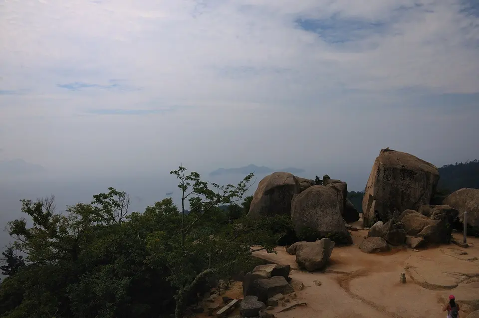
The sacred mountain of the island, 535 metres, is reached by two ropeways from Momijidani Park, a gondola and then a big cable car, to Shishiiwa station, from which a 30-minute path climbs past the hall where the flame Kukai lit is said to have burned for 1,200 years to the summit rocks and a 360-degree view over the Seto Inland Sea, its islands and the city on the far shore. Walk down instead of riding, an hour and a half by the Momijidani or Daisho-in trails, if your legs allow.

  • Plan about 2 h 30 min
  • Ropeway ¥2,000 return, ¥1,100 one way; up 9:00–16:00, last descent 16:30
1.6 km · about 25 min on foot
Senjokaku and the five-storey pagoda
Photo: Taisyo, CC BY 3.0
4Historic hall

Senjokaku and the five-storey pagoda

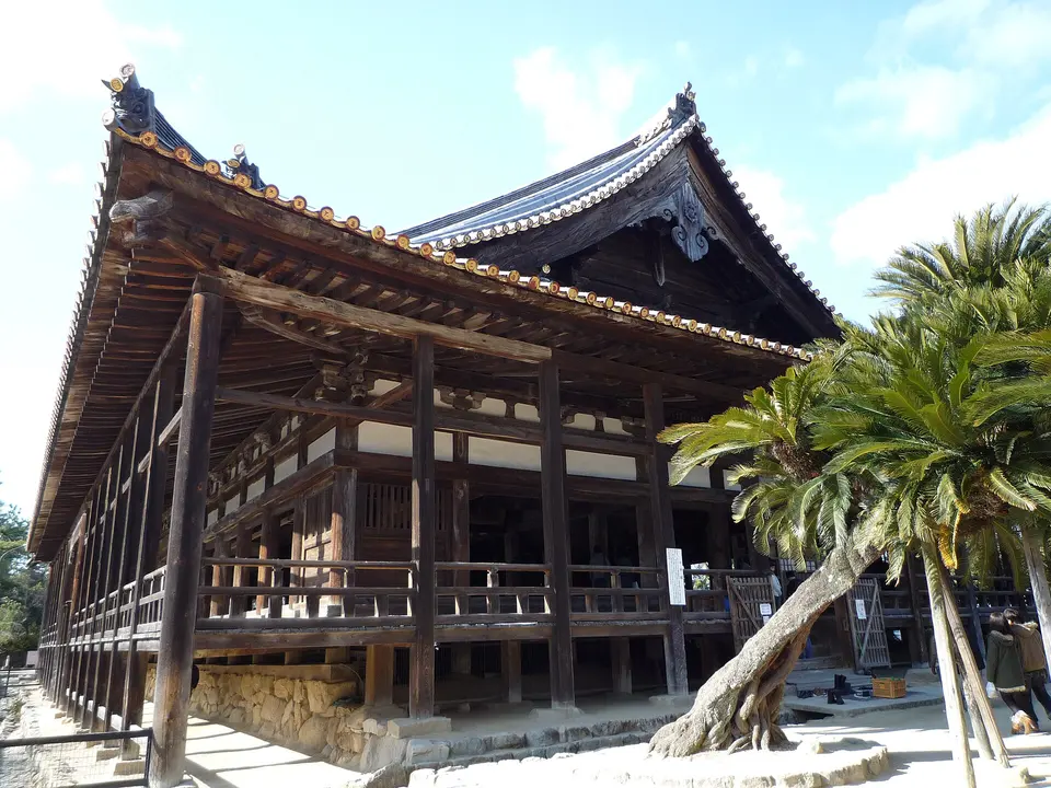
On the hill above the shrine, the 'hall of a thousand mats' is a huge wooden hall that Toyotomi Hideyoshi began in 1587 for the chanting of sutras and that was left unfinished when he died, without walls or ceiling; painted votive plaques hang from its beams and the breeze blows through. The five-storey pagoda of 1407 beside it is the vertical landmark of every view of the island.

  • Plan about 30 min
  • ¥100; 8:30–16:30

Evening

DinnerMost day-trippers leave on the late-afternoon ferries; stay for dinner on Omotesando or at the waterfront cafés and walk back to the shrine after dark, when the great torii is floodlit and the crowds are gone. Ferries run until well into the evening.

Day 3

Mitaki-dera and the Kintai Bridge at Iwakuni

Take the local train to the waterfall temple of Mitaki-dera in the wooded hills on the edge of the city, then the Sanyo line to Iwakuni for the five wooden arches of the Kintai Bridge, the ropeway to the castle and the samurai quarter of Kikko Park, and come back to Hiroshima for oysters in Nagarekawa.

  • 4 sights
  • 930 m on foot
  • Longest walk 930 m
12345 kmN
Stops in order, straight-line distancesRoute in Google Maps ↗

Morning

Mitaki-dera
Photo: Binabik155, CC BY-SA 3.0
1Buddhist temple

Mitaki-dera

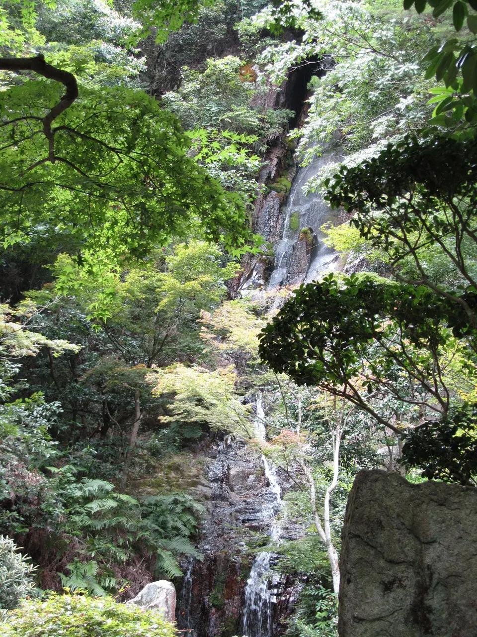
Fifteen minutes' walk uphill from Mitaki station, in a wooded valley on the edge of the city, the temple of the three waterfalls, founded in 809, is the local secret: moss-covered stone Buddhas in their hundreds along the paths, three falls whose water is offered at the Peace Memorial Ceremony each August, and a vermilion pagoda of 1526 brought from Wakayama in 1951 to console the souls of the bomb's victims. In November the maples make it the best autumn walk in Hiroshima.

  • Plan about 1 h 30 min
  • Free, donation box at the gate; open 8:00–17:00

Midday

LunchIwakuni's own dishes are Iwakuni-zushi, a pressed sushi cut in squares, and renkon lotus-root dishes; the restaurants along the river by the bridge and inside Kikko Park serve both, with river views.

Afternoon

JR Kabe line back to Yokogawa, then the Sanyo line to Iwakuni, about an hour in all, and a 20-minute bus to Kintaikyo
Kintai Bridge
Photo: Jakub Hałun, CC BY-SA 4.0
2Historic bridge

Kintai Bridge

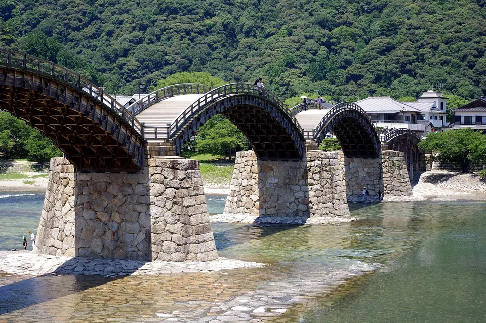
Five wooden arches of 1673, 193 metres long, hop across the Nishiki river on stone piers in the town of Iwakuni, just over the border in Yamaguchi prefecture and 50 minutes from Hiroshima by train; the bridge was rebuilt in the same joinery, without nails, after a flood in 1950 and again in 2004, and crossing it, up and down the humps, is the point. Kikko Park on the far bank has the samurai houses, the white snakes of Iwakuni in their shrine and the ropeway to the castle.

  • Plan about 1 h
  • Crossing ¥500 (¥1,550 on a set ticket with the ropeway and castle); ticket office 8:00–17:00, lit until 22:00
930 m · about 15 min on foot
Iwakuni Castle
Photo: Jakub Hałun, CC BY-SA 4.0
3Castle and viewpoint

Iwakuni Castle

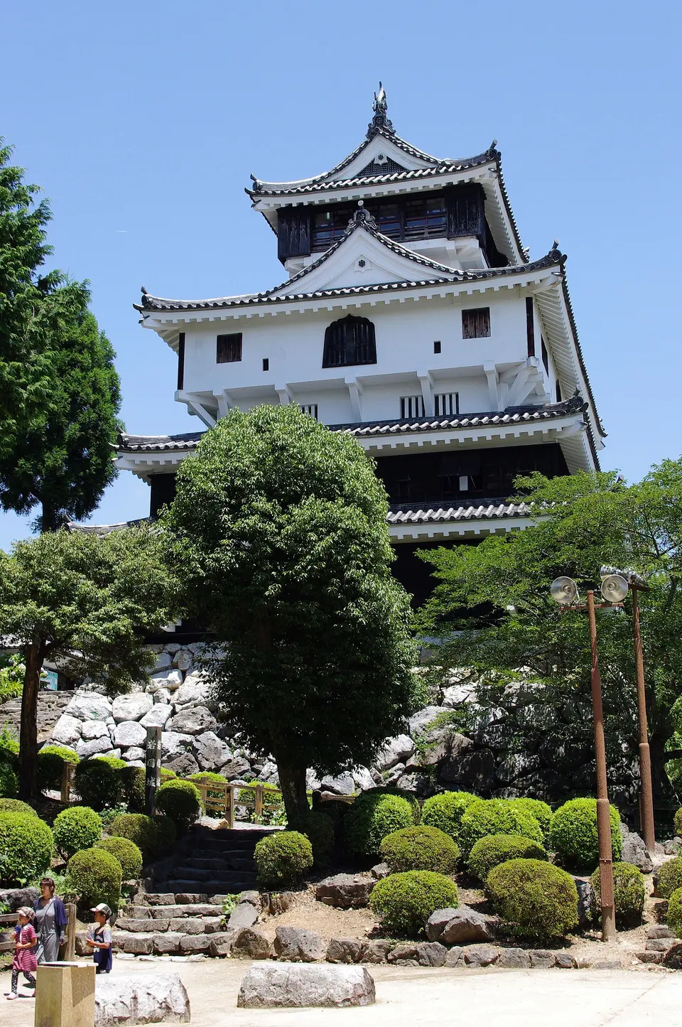
A three-minute ropeway ride from Kikko Park lifts you 200 metres to the ridge where the lord Kikkawa Hiroie built his castle in 1608, only for it to be pulled down seven years later under the one-castle-per-domain law; the keep was rebuilt in 1962 a little closer to the edge, for the view, which takes in the bridge below, the whole town, the river delta and the Inland Sea. Inside are swords and armour; outside, the ten-minute walk from the ropeway station through the woods.

  • Plan about 1 h 15 min
  • 9:00–16:45; ¥350, ropeway ¥560 return

Evening

Train back to Hiroshima, about 50 minutes, then the tram to Ebisu-cho, or a 15-minute walk from the station
Nagarekawa
Photo: Miyuki Meinaka, CC BY-SA 4.0
4Entertainment district

Nagarekawa

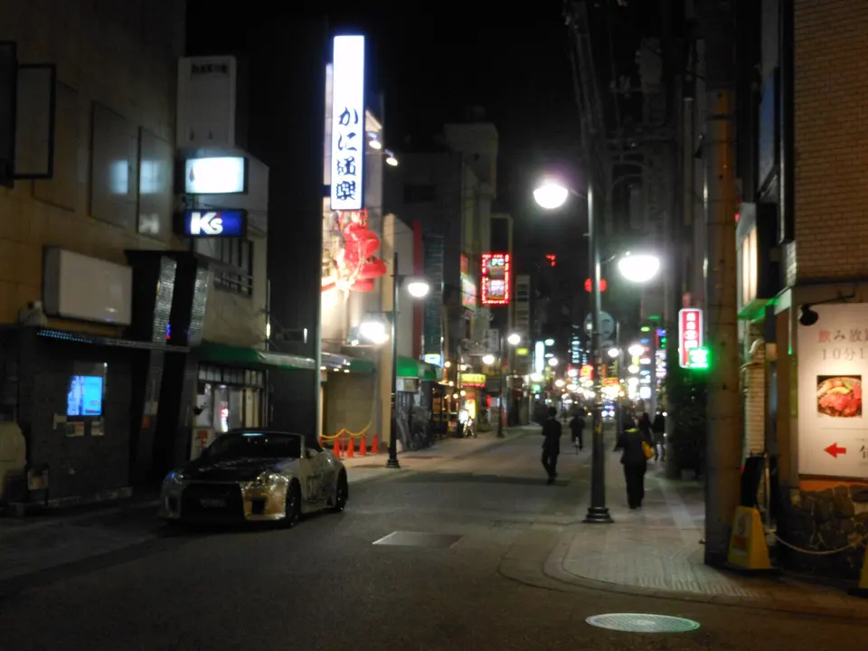
The city's night-life quarter east of Hondori is a grid of small streets with more than a thousand bars, izakaya and restaurants: this is where to eat Hiroshima's oysters, grilled, fried or raw, in the season from October to March, and its tsukemen, cold noodles dipped in a fiery broth, all year, before the standing bars and the sake counters.

  • Plan about 2 h

Good to know in Hiroshima

Opening hours and tickets

  • The Peace Memorial Museum is open 7:30–19:00 from March to July and September to November, 7:30–20:00 in August (to 21:00 on August 5–6) and 7:30–18:00 from December to February; closed December 30–31 and for a few days in mid-February. Adults pay ¥200, high-school students ¥100, younger children free; the last hour of each day is by online reservation.Source: Hiroshima Peace Memorial Museum · checked Sep 2026
  • Hiroshima Castle's main keep closed in March 2026 because of the deterioration of its concrete; the exterior can still be viewed. The restored Ninomaru buildings and the museum shop stay open, 9:00–17:30 from April to September and 9:00–16:30 from October to March, last entry 30 minutes before closing; entry to the Ninomaru buildings is free.Source: Hiroshima Castle, official site · checked Sep 2026
  • Shukkei-en is open 9:00–18:00 from March 16 to September 15 and 9:00–17:00 from September 16 to March 15, with last entry 30 minutes before closing; closed December 29–31. General admission is ¥350, university students ¥150, schoolchildren free.Source: Shukkei-en, official site · checked Sep 2026
  • The Orizuru Tower observatory and shop are open 10:00–18:00, with ticket sales and admission until 30 minutes before closing; adults pay ¥2,200, ages 12–17 ¥1,400, ages 6–11 ¥900 and ages 4–5 ¥600, plus ¥100 to post a crane on the Orizuru Wall.Source: Hiroshima Orizuru Tower · checked Sep 2026
  • Itsukushima Shrine is open 6:30–18:00 from March to October 14, 6:30–17:30 from October 15 to November 30 and 6:30–17:00 in December, with slightly different hours in January and February. Adults pay ¥300 for the shrine, ¥500 for the shrine and treasure hall together; the Senjokaku hall is ¥100 and open 8:30–16:30.Source: Itsukushima Shrine, official site · checked Sep 2026
  • Everyone entering Miyajima by boat pays the Miyajima Visitor Tax of ¥100 per person per visit (preschool children exempt), collected with the boarding ticket or at the ticket gates; the JR Miyajima ferry costs ¥180 one way for adults, with the tax charged separately, and accepts the Japan Rail Pass and JR-West passes.Source: Miyajima Visitor Tax, Hatsukaichi City / JR Miyajima Ferry · checked Sep 2026
  • The Miyajima Ropeway runs up from 9:00 to 16:00, with the final descent at 16:30; adult fares are ¥2,000 return and ¥1,100 one way. The walk from the top station to the summit of Mount Misen and back takes about an hour.Source: Miyajima Ropeway · checked Sep 2026
  • Crossing the Kintai Bridge costs ¥500 for adults and ¥250 for children (one way), with the ticket office open 8:00–17:00 and later in season; the bridge is lit until 22:00 and accessible around the clock. A set ticket covering the bridge, the ropeway and Iwakuni Castle is ¥1,550 for adults and ¥700 for children.Source: Kintaikyo Bridge, Iwakuni City · checked Sep 2026
  • Iwakuni Castle is open 9:00–16:45; admission is ¥350 for adults and ¥200 for children under 12, and the ropeway ¥330 one way or ¥560 return.Source: Iwakuni City Tourism · checked Sep 2026

Getting around

  • Hiroshima's streetcars charge a flat fare of ¥240 for adults and ¥120 for children on the city lines, and the same on the Miyajima line, for example from Genbaku Dome-mae to Hiroden-miyajima-guchi.Source: Hiroshima Electric Railway · checked Sep 2026

3 days in Hiroshima: quick answers

Is 3 days enough for Hiroshima?

Three days cover the Peace Park and the museum, the castle grounds and the garden, a full day on Miyajima, Mitaki-dera and Iwakuni. A fourth day allows the Mazda Museum (free, booked online in advance), the naval town of Kure and its Yamato Museum, the hillside temples of Onomichi, or a second, quieter morning on Miyajima.

Which days should I plan around?

Everything in the plan is open daily; the Peace Memorial Museum closes only on December 30–31, Shukkei-en on December 29–31. What matters on Miyajima is the tide: the shrine looks as it should with water under it at high tide, and at low tide you can walk out to the torii. Check the tide table and put the shrine in the morning or the afternoon accordingly. Hiroshima Castle's main keep closed in March 2026 for earthquake safety; the grounds and the Ninomaru are open and free.

How much do the tickets cost?

The Peace Memorial Museum is ¥200, Shukkei-en ¥350, the Orizuru Tower ¥2,200, Itsukushima Shrine ¥300 (¥500 with the treasure hall), the Misen ropeway ¥2,000 return, Senjokaku ¥100, the Kintai Bridge ¥500 or ¥1,550 on a set ticket with the ropeway and castle. Miyajima charges a ¥100 visitor tax on the ferry, and the JR ferry is ¥180 each way, free with a Japan Rail Pass.

How do I get around?

The trams cover the city on a flat fare of ¥240, paid as you get off, and run to Miyajimaguchi too, more slowly than the JR train. JR trains serve Miyajimaguchi, Mitaki and Iwakuni and are covered by the Japan Rail Pass, as is the JR Miyajima ferry. The city centre itself is a 20-minute walk end to end.

How much walking is this itinerary?

About 4 km in a straight line on day one, all flat; about 3 km on Miyajima plus the ropeway and the last half-hour climb to the summit, which is rocky; and about 2 km on day three, with the uphill walk to Mitaki-dera and the bridge and castle at Iwakuni, where the ropeway does the climb.

Other Hiroshima itineraries

Keep exploring

Where this connects

THE TRIPWOA APP

Go somewhere.
Make it yours.

Build days around what you love. Follow your route, find your next stop and keep the moments along the way.

Get it on Google PlayAvailable for Android
Free to start
Tripwoa home with a Paris trip and nearby places to explore
Tripwoa day plan for New York with a route map and Times Square stop

A day that feels like you.

Sources and method

Places and coordinates: Wikidata and Tripwoa's open-data place catalog (Overture Maps Foundation, © OpenStreetMap contributors). Photos: Wikimedia Commons, credited on each image. Practical rules: the official sources linked in each note, checked in September 2026.

How this plan was made: Tripwoa's planner drafted the day order from real coordinates and typical visit times. Each stop was then reviewed, reordered where needed and rewritten with AI assistance. Walking distances are straight-line estimates, so allow a little extra time on real streets.