3-day itinerary · Canada

3 Days in Vancouver

A realistic first-timer plan that keeps each day on one side of the water: Canada Place, Gastown, the totem poles and aquarium of Stanley Park and sunset at English Bay; Granville Island's market, Kitsilano Beach and the Museum of Anthropology and Nitobe garden at UBC; then the North Shore with the Capilano Suspension Bridge, the Grouse Mountain Skyride and the SeaBus home. Every stop comes with walking distances and the opening rules that matter in 2026.

  • 3days
  • 12sights
  • 6.4 kmon foot between sights

Updated 12 September 2026 · 12 official sources checked · report an error

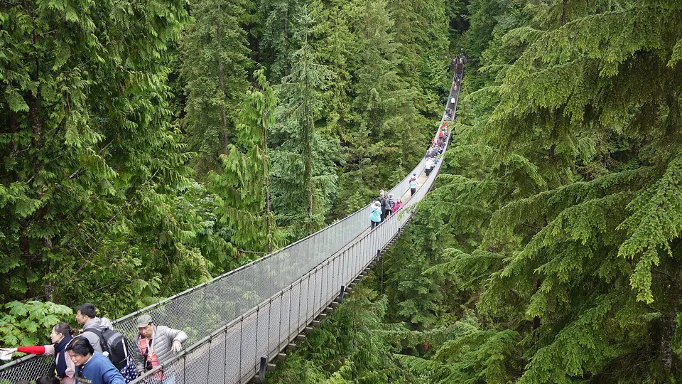
Capilano Suspension Bridge Park
Photo: Markus Säynevirta, CC BY-SA 4.0

Downtown and Stanley Park, then Granville Island and UBC, then the North Shore

Vancouver's sights sit around a harbour and an inlet, so the plan uses the water as much as the streets: day one walks from Canada Place through Gastown and along the Coal Harbour seawall into Stanley Park, ending at English Bay; day two crosses False Creek by Aquabus to Granville Island, follows the shore to Kitsilano and continues to the museums of UBC; day three takes the free shuttle to Capilano, the Skyride up Grouse Mountain and the SeaBus back from Lonsdale Quay. The Museum of Anthropology is closed on Mondays between mid-October and mid-May, so keep day two off a winter Monday.

At a glance

Ways to use these days

If it rains
2 of the stops are indoors — Vancouver Aquarium · Museum of Anthropology at UBC
Outdoors
English Bay Beach · Kitsilano Beach
Lightest day on foot
Day 1 — 4.7 km between stops
Most walking
Day 3 — 13.9 km

Day 1

Downtown, Stanley Park and English Bay

Start under the sails of Canada Place, browse Gastown's brick streets to the steam clock, follow the Coal Harbour seawall into Stanley Park for the totem poles and the aquarium, then cross the park past Lost Lagoon to English Bay for sunset.

  • 5 sights
  • 4.7 km on foot
  • Longest walk 1.8 km
12345500 mN
Stops in order, straight-line distancesWalking route in Google Maps ↗

Morning

Canada Place
Photo: Dietmar Rabich, CC BY-SA 4.0
1Waterfront landmark

Canada Place

The five white sails of the 1986 Expo pavilion, now the cruise terminal and convention centre, mark the start of the waterfront: walk the promenade around it for the harbour, the seaplanes and the North Shore mountains, and note the spot, because the free Capilano shuttle leaves from here on day three.

  • Plan about 30 min
430 m · about 7 min on foot
Gastown and the Steam Clock
Photo: Dietmar Rabich, CC BY-SA 4.0
2Historic district

Gastown and the Steam Clock

Vancouver began here in 1867 around 'Gassy Jack' Deighton's saloon; the Victorian brick blocks along Water Street now hold boutiques, coffee roasters and restaurants. The steam clock on the corner of Cambie Street whistles the quarter hours on steam from the city's heating system.

  • Plan about 1 h

Midday

LunchGastown has the widest choice, from coffee roasters to some of the city's best-known restaurants; picnic supplies can be carried into the park.

Afternoon

1.8 km · about 28 min on foot
Stanley Park: Brockton Point totem poles
Photo: dronepicr, CC BY 2.0
3Park and totem poles

Stanley Park: Brockton Point totem poles

The 400-hectare peninsula of old forest beside downtown is ringed by the 9-kilometre seawall; the nine totem poles at Brockton Point, carved by Kwakwaka'wakw, Haida, Nuu-chah-nulth and Squamish artists, are the most visited spot in British Columbia. Rent a bike at Coal Harbour if you want to circle the whole park.

  • Plan about 1 h 30 min
  • Free; the seawall loop takes 2 to 3 hours on foot
740 m · about 12 min on foot
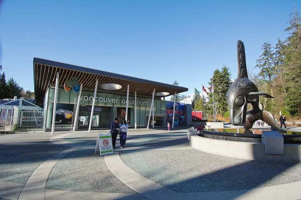
Vancouver Aquarium
Photo: Iiii I I I, CC BY 4.0
4Aquarium

Vancouver Aquarium

Canada's largest aquarium, in the middle of Stanley Park, keeps sea otters, sea lions, penguins and a rainforest gallery of sloths and caimans, along with the Pacific Northwest tanks of wolf eels and giant octopus. Bill Reid's bronze killer whale stands at the entrance.

  • Plan about 2 h
  • Timed tickets; closes 17:00, last entry 15:30
1.7 km · about 27 min on foot
English Bay Beach
Photo: Dietmar Rabich, CC BY-SA 4.0
5Beach

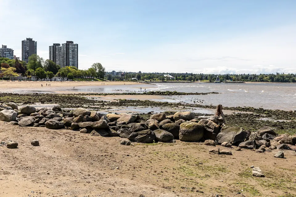
English Bay Beach

The West End's sunset beach at the foot of Denman Street, with the seawall, the Inukshuk stone figure and the A-maze-ing Laughter bronze figures in Morton Park; the bay fills with kayaks in summer and the Celebration of Light fireworks are launched from a barge here in late July.

  • Plan about 45 min

Evening

DinnerDenman and Davie streets, behind English Bay, are lined with sushi, ramen and casual restaurants of every kind.

Day 2

Granville Island, Kitsilano and UBC

Ride the Aquabus across False Creek to the Public Market, walk the seawall through Vanier Park to Kitsilano Beach for lunch, then take the bus out to the University of British Columbia for the Museum of Anthropology's Great Hall and the Nitobe garden.

  • 4 sights
  • 1.7 km on foot
  • Longest walk 1.5 km
12342 kmN
Stops in order, straight-line distancesRoute in Google Maps ↗

Morning

Granville Island Public Market
Photo: Ymblanter, CC BY-SA 4.0
1Public market

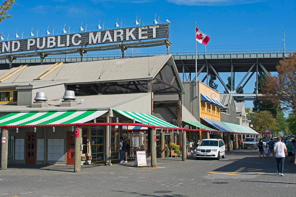
Granville Island Public Market

Under the Granville Street Bridge, a former industrial island holds the city's best food market: fish, cheese, bakeries and produce stalls, food counters and a waterside food court, plus artisan workshops, the Kids Market and a brewery. Arrive by the tiny Aquabus ferries from downtown.

  • Plan about 2 h
  • Market open daily 9:00–18:00

Midday

LunchKitsilano's West 4th Avenue and Cornwall Avenue, a few minutes back from the beach, are full of cafés and restaurants; the market's food court is the alternative before you leave the island.
1.5 km · about 23 min on foot
Kitsilano Beach
Photo: Xicotencatl, CC BY-SA 4.0
2Beach

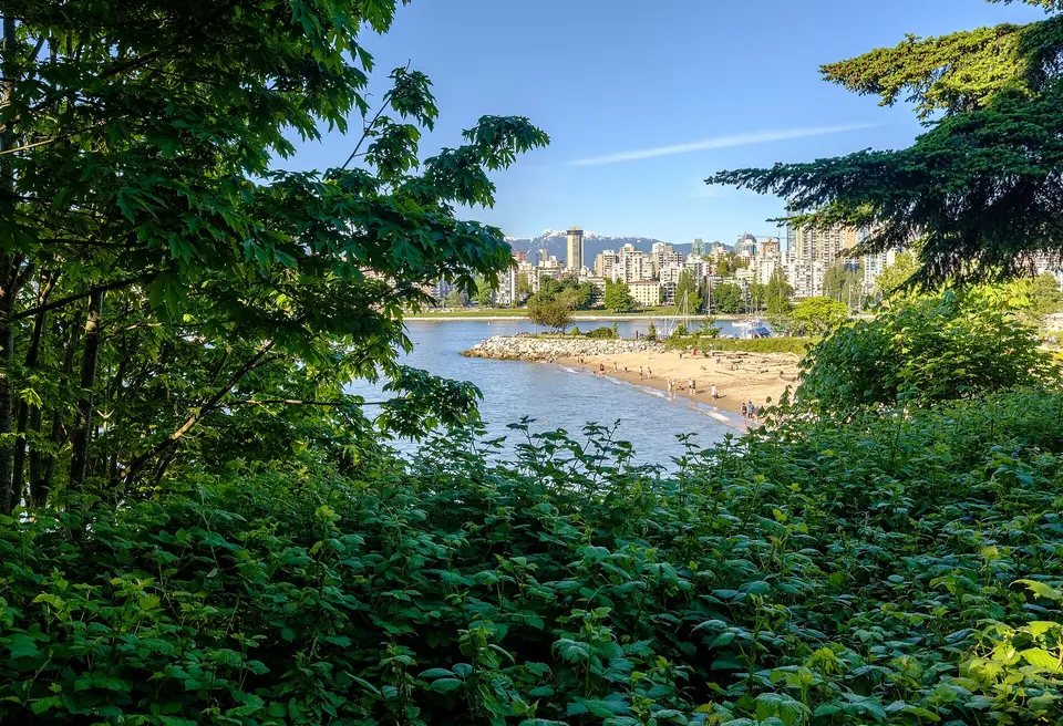
Kitsilano Beach

Kits Beach is the city's most popular strand, with the skyline and mountains across the water, volleyball courts and the 137-metre saltwater Kitsilano Pool at its western end; the seawall from Granville Island runs here through Vanier Park past the Museum of Vancouver and the Space Centre.

  • Plan about 1 h

Afternoon

About 30 minutes by bus along West 4th Avenue to UBC, then a 10-minute walk across campus; a taxi takes 20 minutes
Museum of Anthropology at UBC
Photo: Xicotencatl, CC BY-SA 4.0
3Museum

Museum of Anthropology at UBC

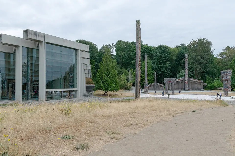
Arthur Erickson's concrete-and-glass Great Hall, rebuilt after seismic work and reopened in 2024, holds towering Northwest Coast totem poles, house posts and canoes against the forest and sea; Bill Reid's cedar Raven and the First Men is in its own rotunda, and the Multiversity Galleries hold thousands more objects in glass drawers.

  • Plan about 2 h
  • Open daily 10:00–17:00, Thursdays to 21:00; closed Mondays from mid-October to mid-May
280 m · about 4 min on foot
Nitobe Memorial Garden
Photo: Xicotencatl, CC BY-SA 4.0
4Japanese garden

Nitobe Memorial Garden

A ten-minute walk from the museum, this authentic Japanese stroll garden, laid out in 1960 with a tea house, lanterns, bridges and a pond of koi, is ranked among the finest outside Japan; every stone and tree was placed to a plan.

  • Plan about 45 min
  • Open mid-March to end of October; closed Mondays outside summer

Evening

DinnerBack downtown, Yaletown's converted warehouses on Hamilton and Mainland streets hold restaurants and patios; the Aquabus returns there from Granville Island until late.

Day 3

The North Shore: Capilano, Grouse and the SeaBus

Take the free shuttle from Canada Place to the Capilano Suspension Bridge and its treetop walkways, continue up the road to the Grouse Mountain Skyride for the summit and the grizzly refuge, then come down to Lonsdale Quay for dinner and the 12-minute SeaBus back across the harbour.

  • 3 sights
  • Transport between sights
1232 kmN
Stops in order, straight-line distancesDriving route in Google Maps ↗

Morning

Capilano Suspension Bridge Park
Photo: Markus Säynevirta, CC BY-SA 4.0
1Suspension bridge and park

Capilano Suspension Bridge Park

The 137-metre bridge has swayed 70 metres above the Capilano River since 1889 (the current cable version dates from 1956); on the far side the Treetops Adventure walkways link seven Douglas firs and the Cliffwalk hangs off the granite canyon wall. A free shuttle runs from Canada Place.

  • Plan about 2 h 30 min
  • Open every day except 25 December; timed-entry tickets online; free shuttle from Canada Place

Midday

LunchCapilano's Cliff House restaurant and the cafés at the Grouse base cover lunch; the summit chalet also has a bistro.

Afternoon

TransLink bus 236 or a short taxi ride up Capilano Road to the Skyride base, about 10 minutes
Grouse Mountain
Photo: Rollan Budi, CC BY-SA 2.0
2Mountain and Skyride

Grouse Mountain

The Skyride gondola climbs 1,100 metres from the valley to the summit plateau in about eight minutes, to a view over the city, the harbour and, on clear days, Vancouver Island; in the green season the ticket includes the lumberjack show, the birds of prey demonstration, the grizzly bear refuge and the Peak chairlift.

  • Plan about 3 h
  • Open daily 8:45–21:00; Mountain Admission includes the Skyride

Evening

Bus 236 down to Lonsdale Quay, about 25 minutes, or 15 minutes by taxi
Lonsdale Quay Market and the SeaBus
Photo: Tavis Ford, CC BY 2.0
3Market and ferry

Lonsdale Quay Market and the SeaBus

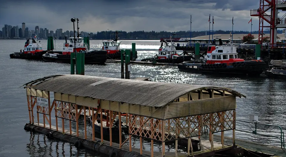
The North Shore's market hall sits on the water beside the SeaBus terminal: fish and produce stalls, a food hall and a viewing deck facing the whole downtown skyline. The SeaBus back to Waterfront Station takes 12 minutes and runs every 15 minutes, the best-value harbour crossing in the city.

  • Plan about 1 h
  • Market 9:00–19:00; SeaBus every 15 minutes, 12 minutes across

Good to know in Vancouver

Tickets and opening days

  • Capilano Suspension Bridge Park is open every day of the year except 25 December, with hours that change by season. Tickets are timed-entry and cheaper online; most visitors spend two to three hours.Source: Capilano Suspension Bridge Park · checked Sep 2026
  • The park's free shuttle runs year-round from Canada Place and downtown hotel stops; the ride from Canada Place takes about 20 minutes, and proof of admission is needed for the return trip.Source: Capilano Suspension Bridge Park · checked Sep 2026
  • Grouse Mountain is open daily 8:45–21:00; a Mountain Admission ticket includes the round-trip Skyride and, in the green season, the lumberjack show, the birds-in-motion demonstration, the grizzly bear habitat and the Peak chairlift.Source: Grouse Mountain · checked Sep 2026
  • Vancouver Aquarium tickets are timed and should be booked online for a guaranteed slot; the last entry is 15:30 and the aquarium closes at 17:00. Most visitors spend 90 minutes to two hours.Source: Vancouver Aquarium · checked Sep 2026
  • The Museum of Anthropology is open seven days a week 10:00–17:00 and until 21:00 on Thursdays, except that from 15 October to 15 May it is closed on Mondays.Source: Museum of Anthropology at UBC · checked Sep 2026
  • Nitobe Memorial Garden is open from 14 March to 31 October, Tuesday to Sunday 10:00–16:30, and daily in summer (18 May to 7 September) with late opening to 20:00 on Thursdays.Source: UBC Botanical Garden · checked Sep 2026
  • Granville Island Public Market is open daily 9:00–18:00, including most statutory holidays; it closes on Mondays in January only, for maintenance.Source: Granville Island · checked Sep 2026
  • The Stanley Park seawall is 9 km around the park and takes two to three hours to walk or about an hour to cycle; the nine totem poles at Brockton Point are the most visited attraction in British Columbia.Source: City of Vancouver · checked Sep 2026
  • Lonsdale Quay Market's ground-floor market is open daily 9:00–19:00 and the food hall from 10:00 until 21:00 (23:00 on Fridays and Saturdays).Source: Lonsdale Quay Market · checked Sep 2026

Getting around

  • TransLink's card readers on buses, SkyTrain and SeaBus accept contactless Visa, Mastercard, American Express and Interac debit cards and phone wallets, with transfers across all modes on one fare for 90 minutes. Buses are always a one-zone fare.Source: TransLink · checked Sep 2026
  • The SeaBus crosses Burrard Inlet between Waterfront Station and Lonsdale Quay in 12 minutes, every 15 minutes through the day, seven days a week.Source: TransLink · checked Sep 2026
  • Aquabus ferries run across False Creek every 5 minutes to Granville Island and every 15 minutes to the other docks, from 7:00 to 23:00 daily.Source: Aquabus · checked Sep 2026

3 days in Vancouver: quick answers

Is 3 days enough for Vancouver?

Three days cover downtown and Stanley Park, Granville Island and UBC, and the North Shore. A fourth day allows Queen Elizabeth Park and the VanDusen garden, Science World and the False Creek seawall, Lynn Canyon's free suspension bridge, or a day trip up the Sea-to-Sky Highway to Whistler.

Do I need a car?

No. Days one and three use the seawall, the free Capilano shuttle, a bus and the SeaBus; day two uses the Aquabus and a city bus. TransLink buses, SkyTrain and SeaBus accept contactless bank cards with a 90-minute transfer.

Which days should I plan around?

The Museum of Anthropology is closed on Mondays from mid-October to mid-May, and Nitobe Memorial Garden closes from November to mid-March and on Mondays outside summer, so avoid a winter Monday for day two. Everything else is open daily.

Can I cycle the Stanley Park seawall instead?

Yes. Bike rentals cluster around Denman Street and Coal Harbour, the 9-kilometre loop takes about an hour and runs one way, anticlockwise; the totem poles and the aquarium are both on or near the route.

How much walking is this itinerary?

Day one is the long one, about 4.5 km in a straight line along the seawall and through Stanley Park (rent a bike to shorten it); day two is under 2 km plus a bus; day three is done by shuttle, bus, gondola and SeaBus with little walking.

Other Vancouver itineraries

Keep exploring

Where this connects

THE TRIPWOA APP

Go somewhere.
Make it yours.

Build days around what you love. Follow your route, find your next stop and keep the moments along the way.

Get it on Google PlayAvailable for Android
Free to start
Tripwoa home with a Paris trip and nearby places to explore
Tripwoa day plan for New York with a route map and Times Square stop

A day that feels like you.

Sources and method

Places and coordinates: Wikidata and Tripwoa's open-data place catalog (Overture Maps Foundation, © OpenStreetMap contributors). Photos: Wikimedia Commons, credited on each image. Practical rules: the official sources linked in each note, checked in September 2026.

How this plan was made: Tripwoa's planner drafted the day order from real coordinates and typical visit times. Each stop was then reviewed, reordered where needed and rewritten with AI assistance. Walking distances are straight-line estimates, so allow a little extra time on real streets.